You are here: Home > Network List > TA - USArray Transportable Network (new EarthScope stations) Stations List
> Station E20K Nigu River, AK, USA > Earthquake Result Viewer
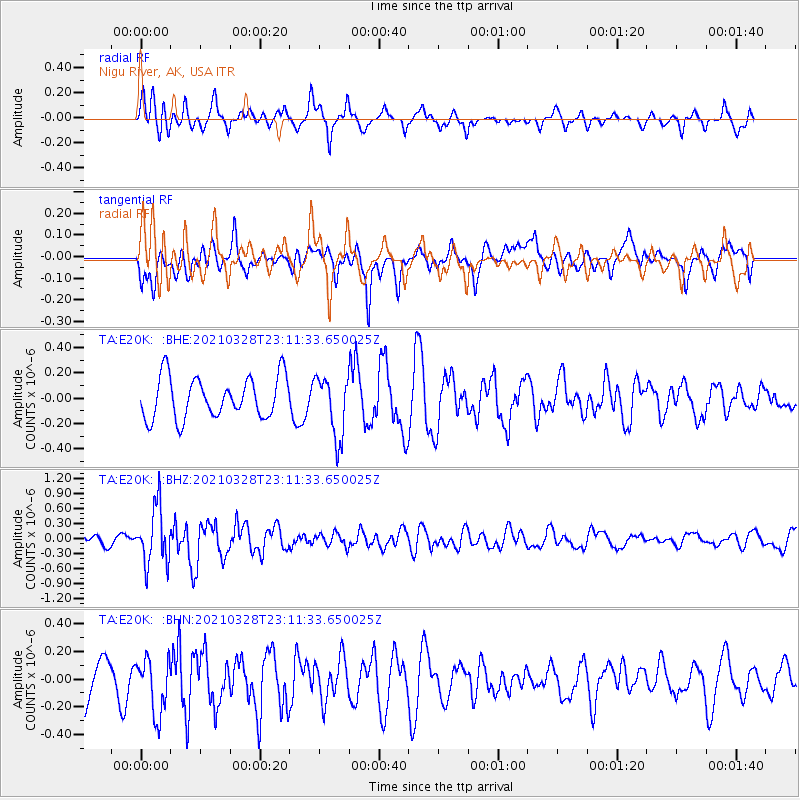
E20K Nigu River, AK, USA - Earthquake Result Viewer
*The percent match for this event was below the threshold and hence no stack was calculated.
| Earthquake location: |
Northern Mid-Atlantic Ridge |
| Earthquake latitude/longitude: |
43.6/-28.8 |
| Earthquake time(UTC): |
2021/03/28 (087) 23:01:46 GMT |
| Earthquake Depth: |
10 km |
| Earthquake Magnitude: |
5.8 Mww |
| Earthquake Catalog/Contributor: |
NEIC PDE/us |
|
| Network: |
TA USArray Transportable Network (new EarthScope stations) |
| Station: |
E20K Nigu River, AK, USA |
| Lat/Lon: |
68.26 N/156.19 W |
| Elevation: |
866 m |
|
| Distance: |
61.7 deg |
| Az: |
340.36 deg |
| Baz: |
40.909 deg |
| Ray Param: |
$rayparam |
*The percent match for this event was below the threshold and hence was not used in the summary stack. |
|
| Radial Match: |
63.432438 % |
| Radial Bump: |
400 |
| Transverse Match: |
58.44893 % |
| Transverse Bump: |
400 |
| SOD ConfigId: |
24334971 |
| Insert Time: |
2021-04-11 23:27:51.559 +0000 |
| GWidth: |
2.5 |
| Max Bumps: |
400 |
| Tol: |
0.001 |
|
Signal To Noise
| Channel | StoN | STA | LTA |
| TA:E20K: :BHZ:20210328T23:11:33.650025Z | 4.254435 | 5.7654614E-7 | 1.3551649E-7 |
| TA:E20K: :BHN:20210328T23:11:33.650025Z | 1.0712788 | 2.0208475E-7 | 1.886388E-7 |
| TA:E20K: :BHE:20210328T23:11:33.650025Z | 1.4792387 | 2.404089E-7 | 1.6252204E-7 |
| Arrivals |
| Ps | |
| PpPs | |
| PsPs/PpSs | |


