You are here: Home > Network List > TA - USArray Transportable Network (new EarthScope stations) Stations List
> Station G21K Allakaket, AK, USA > Earthquake Result Viewer
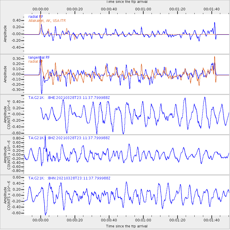
G21K Allakaket, AK, USA - Earthquake Result Viewer
*The percent match for this event was below the threshold and hence no stack was calculated.
| Earthquake location: |
Northern Mid-Atlantic Ridge |
| Earthquake latitude/longitude: |
43.6/-28.8 |
| Earthquake time(UTC): |
2021/03/28 (087) 23:01:46 GMT |
| Earthquake Depth: |
10 km |
| Earthquake Magnitude: |
5.8 Mww |
| Earthquake Catalog/Contributor: |
NEIC PDE/us |
|
| Network: |
TA USArray Transportable Network (new EarthScope stations) |
| Station: |
G21K Allakaket, AK, USA |
| Lat/Lon: |
66.52 N/153.51 W |
| Elevation: |
446 m |
|
| Distance: |
62.3 deg |
| Az: |
338.166 deg |
| Baz: |
42.354 deg |
| Ray Param: |
$rayparam |
*The percent match for this event was below the threshold and hence was not used in the summary stack. |
|
| Radial Match: |
39.644928 % |
| Radial Bump: |
377 |
| Transverse Match: |
48.64157 % |
| Transverse Bump: |
400 |
| SOD ConfigId: |
24334971 |
| Insert Time: |
2021-04-11 23:28:12.873 +0000 |
| GWidth: |
2.5 |
| Max Bumps: |
400 |
| Tol: |
0.001 |
|
Signal To Noise
| Channel | StoN | STA | LTA |
| TA:G21K: :BHZ:20210328T23:11:37.799988Z | 2.5459692 | 3.8380725E-7 | 1.5075094E-7 |
| TA:G21K: :BHN:20210328T23:11:37.799988Z | 1.5888681 | 3.3048923E-7 | 2.0800293E-7 |
| TA:G21K: :BHE:20210328T23:11:37.799988Z | 1.5673114 | 3.0796156E-7 | 1.9649035E-7 |
| Arrivals |
| Ps | |
| PpPs | |
| PsPs/PpSs | |


