You are here: Home > Network List > TA - USArray Transportable Network (new EarthScope stations) Stations List
> Station H31M Peel River, Yukon, CAN > Earthquake Result Viewer
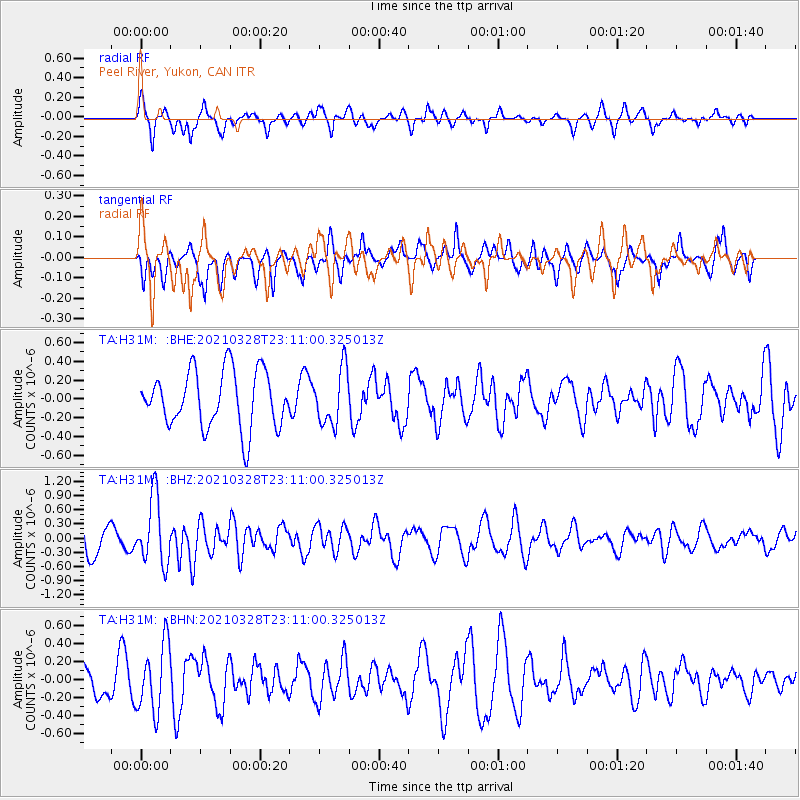
H31M Peel River, Yukon, CAN - Earthquake Result Viewer
*The percent match for this event was below the threshold and hence no stack was calculated.
| Earthquake location: |
Northern Mid-Atlantic Ridge |
| Earthquake latitude/longitude: |
43.6/-28.8 |
| Earthquake time(UTC): |
2021/03/28 (087) 23:01:46 GMT |
| Earthquake Depth: |
10 km |
| Earthquake Magnitude: |
5.8 Mww |
| Earthquake Catalog/Contributor: |
NEIC PDE/us |
|
| Network: |
TA USArray Transportable Network (new EarthScope stations) |
| Station: |
H31M Peel River, Yukon, CAN |
| Lat/Lon: |
65.81 N/134.34 W |
| Elevation: |
642 m |
|
| Distance: |
56.9 deg |
| Az: |
331.703 deg |
| Baz: |
56.614 deg |
| Ray Param: |
$rayparam |
*The percent match for this event was below the threshold and hence was not used in the summary stack. |
|
| Radial Match: |
64.9328 % |
| Radial Bump: |
389 |
| Transverse Match: |
52.25564 % |
| Transverse Bump: |
381 |
| SOD ConfigId: |
24334971 |
| Insert Time: |
2021-04-11 23:28:26.318 +0000 |
| GWidth: |
2.5 |
| Max Bumps: |
400 |
| Tol: |
0.001 |
|
Signal To Noise
| Channel | StoN | STA | LTA |
| TA:H31M: :BHZ:20210328T23:11:00.325013Z | 2.9932575 | 7.0042347E-7 | 2.340004E-7 |
| TA:H31M: :BHN:20210328T23:11:00.325013Z | 1.4277285 | 3.774585E-7 | 2.6437695E-7 |
| TA:H31M: :BHE:20210328T23:11:00.325013Z | 0.98306566 | 2.9539663E-7 | 3.0048517E-7 |
| Arrivals |
| Ps | |
| PpPs | |
| PsPs/PpSs | |


