You are here: Home > Network List > TA - USArray Transportable Network (new EarthScope stations) Stations List
> Station I17K Unalakleet, AK, USA > Earthquake Result Viewer
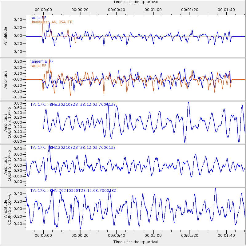
I17K Unalakleet, AK, USA - Earthquake Result Viewer
*The percent match for this event was below the threshold and hence no stack was calculated.
| Earthquake location: |
Northern Mid-Atlantic Ridge |
| Earthquake latitude/longitude: |
43.6/-28.8 |
| Earthquake time(UTC): |
2021/03/28 (087) 23:01:46 GMT |
| Earthquake Depth: |
10 km |
| Earthquake Magnitude: |
5.8 Mww |
| Earthquake Catalog/Contributor: |
NEIC PDE/us |
|
| Network: |
TA USArray Transportable Network (new EarthScope stations) |
| Station: |
I17K Unalakleet, AK, USA |
| Lat/Lon: |
63.89 N/160.70 W |
| Elevation: |
105 m |
|
| Distance: |
66.3 deg |
| Az: |
338.919 deg |
| Baz: |
36.159 deg |
| Ray Param: |
$rayparam |
*The percent match for this event was below the threshold and hence was not used in the summary stack. |
|
| Radial Match: |
59.866825 % |
| Radial Bump: |
400 |
| Transverse Match: |
50.723255 % |
| Transverse Bump: |
400 |
| SOD ConfigId: |
24334971 |
| Insert Time: |
2021-04-11 23:28:26.611 +0000 |
| GWidth: |
2.5 |
| Max Bumps: |
400 |
| Tol: |
0.001 |
|
Signal To Noise
| Channel | StoN | STA | LTA |
| TA:I17K: :BHZ:20210328T23:12:03.700013Z | 2.0950797 | 5.5494735E-7 | 2.6488127E-7 |
| TA:I17K: :BHN:20210328T23:12:03.700013Z | 1.272781 | 2.3728576E-7 | 1.8643094E-7 |
| TA:I17K: :BHE:20210328T23:12:03.700013Z | 1.2778641 | 2.8273794E-7 | 2.2125825E-7 |
| Arrivals |
| Ps | |
| PpPs | |
| PsPs/PpSs | |


