You are here: Home > Network List > US - United States National Seismic Network Stations List
> Station MSO Missoula, Montana, USA > Earthquake Result Viewer
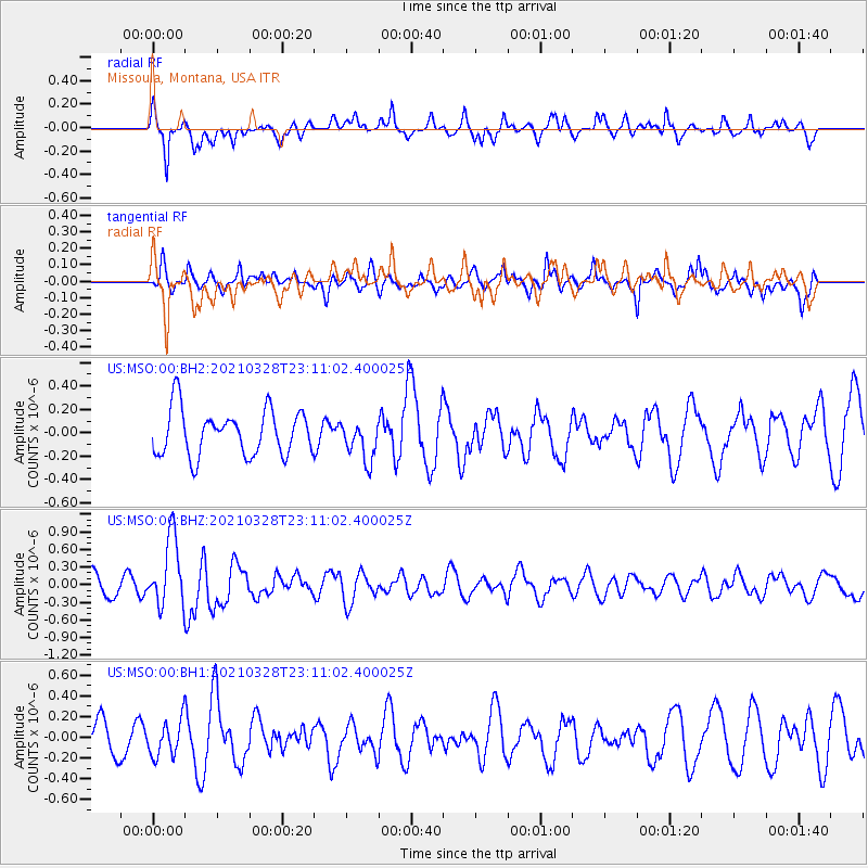
MSO Missoula, Montana, USA - Earthquake Result Viewer
*The percent match for this event was below the threshold and hence no stack was calculated.
| Earthquake location: |
Northern Mid-Atlantic Ridge |
| Earthquake latitude/longitude: |
43.6/-28.8 |
| Earthquake time(UTC): |
2021/03/28 (087) 23:01:46 GMT |
| Earthquake Depth: |
10 km |
| Earthquake Magnitude: |
5.8 Mww |
| Earthquake Catalog/Contributor: |
NEIC PDE/us |
|
| Network: |
US United States National Seismic Network |
| Station: |
MSO Missoula, Montana, USA |
| Lat/Lon: |
46.83 N/113.94 W |
| Elevation: |
1264 m |
|
| Distance: |
57.2 deg |
| Az: |
305.495 deg |
| Baz: |
59.406 deg |
| Ray Param: |
$rayparam |
*The percent match for this event was below the threshold and hence was not used in the summary stack. |
|
| Radial Match: |
67.12841 % |
| Radial Bump: |
400 |
| Transverse Match: |
64.46874 % |
| Transverse Bump: |
400 |
| SOD ConfigId: |
24334971 |
| Insert Time: |
2021-04-11 23:32:08.938 +0000 |
| GWidth: |
2.5 |
| Max Bumps: |
400 |
| Tol: |
0.001 |
|
Signal To Noise
| Channel | StoN | STA | LTA |
| US:MSO:00:BHZ:20210328T23:11:02.400025Z | 2.6704571 | 5.902248E-7 | 2.2102012E-7 |
| US:MSO:00:BH1:20210328T23:11:02.400025Z | 1.247229 | 1.7155469E-7 | 1.3754868E-7 |
| US:MSO:00:BH2:20210328T23:11:02.400025Z | 0.8754888 | 1.7045058E-7 | 1.946919E-7 |
| Arrivals |
| Ps | |
| PpPs | |
| PsPs/PpSs | |


