You are here: Home > Network List > TA - USArray Transportable Network (new EarthScope stations) Stations List
> Station G21K Allakaket, AK, USA > Earthquake Result Viewer
G21K Allakaket, AK, USA - Earthquake Result Viewer
*The percent match for this event was below the threshold and hence no stack was calculated.
| Earthquake location: |
Xizang |
| Earthquake latitude/longitude: |
34.4/87.7 |
| Earthquake time(UTC): |
2021/03/29 (088) 17:27:23 GMT |
| Earthquake Depth: |
10 km |
| Earthquake Magnitude: |
5.6 mww |
| Earthquake Catalog/Contributor: |
NEIC PDE/us |
|
| Network: |
TA USArray Transportable Network (new EarthScope stations) |
| Station: |
G21K Allakaket, AK, USA |
| Lat/Lon: |
66.52 N/153.51 W |
| Elevation: |
446 m |
|
| Distance: |
69.2 deg |
| Az: |
22.07 deg |
| Baz: |
309.131 deg |
| Ray Param: |
$rayparam |
*The percent match for this event was below the threshold and hence was not used in the summary stack. |
|
| Radial Match: |
61.34296 % |
| Radial Bump: |
400 |
| Transverse Match: |
55.500282 % |
| Transverse Bump: |
400 |
| SOD ConfigId: |
24334971 |
| Insert Time: |
2021-04-12 17:40:45.250 +0000 |
| GWidth: |
2.5 |
| Max Bumps: |
400 |
| Tol: |
0.001 |
|
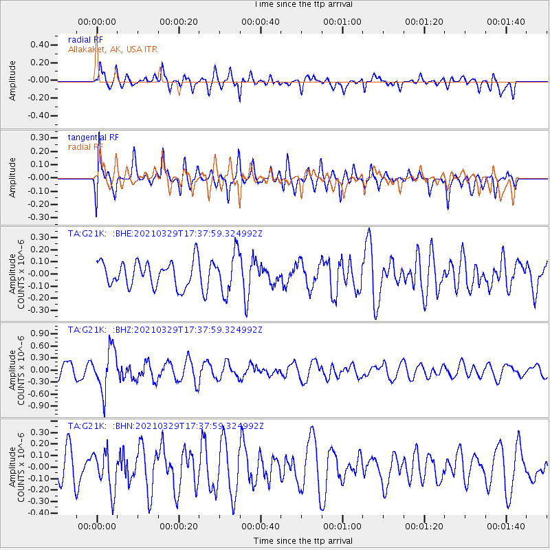
Signal To Noise
| Channel | StoN | STA | LTA |
| TA:G21K: :BHZ:20210329T17:37:59.324992Z | 4.0086126 | 5.4027817E-7 | 1.3477933E-7 |
| TA:G21K: :BHN:20210329T17:37:59.324992Z | 0.93402225 | 1.753683E-7 | 1.8775603E-7 |
| TA:G21K: :BHE:20210329T17:37:59.324992Z | 1.619481 | 1.6635917E-7 | 1.0272375E-7 |
| Arrivals |
| Ps | |
| PpPs | |
| PsPs/PpSs | |


