You are here: Home > Network List > PF - Volcanologic Network of Piton de Fournaise-OVPF Stations List
> Station HIM cratere Himiltrude > Earthquake Result Viewer
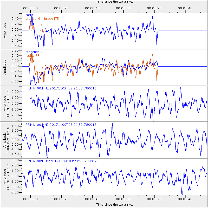
HIM cratere Himiltrude - Earthquake Result Viewer
*The percent match for this event was below the threshold and hence no stack was calculated.
| Earthquake location: |
Halmahera, Indonesia |
| Earthquake latitude/longitude: |
1.9/127.1 |
| Earthquake time(UTC): |
2017/11/09 (313) 03:11:02 GMT |
| Earthquake Depth: |
99 km |
| Earthquake Magnitude: |
5.2 Mww |
| Earthquake Catalog/Contributor: |
NEIC PDE/us |
|
| Network: |
PF Volcanologic Network of Piton de Fournaise-OVPF |
| Station: |
HIM cratere Himiltrude |
| Lat/Lon: |
21.21 S/55.72 E |
| Elevation: |
1958 m |
|
| Distance: |
73.4 deg |
| Az: |
247.332 deg |
| Baz: |
81.268 deg |
| Ray Param: |
$rayparam |
*The percent match for this event was below the threshold and hence was not used in the summary stack. |
|
| Radial Match: |
42.95942 % |
| Radial Bump: |
400 |
| Transverse Match: |
30.468534 % |
| Transverse Bump: |
400 |
| SOD ConfigId: |
2429771 |
| Insert Time: |
2017-11-23 03:12:42.298 +0000 |
| GWidth: |
2.5 |
| Max Bumps: |
400 |
| Tol: |
0.001 |
|
Signal To Noise
| Channel | StoN | STA | LTA |
| PF:HIM:00:HHZ:20171109T03:21:52.78001Z | 0.6693105 | 5.5348625E-7 | 8.269499E-7 |
| PF:HIM:00:HHN:20171109T03:21:52.78001Z | 1.2578725 | 1.0365305E-6 | 8.2403466E-7 |
| PF:HIM:00:HHE:20171109T03:21:52.78001Z | 1.3276485 | 9.2616216E-7 | 6.975959E-7 |
| Arrivals |
| Ps | |
| PpPs | |
| PsPs/PpSs | |


