You are here: Home > Network List > TA - USArray Transportable Network (new EarthScope stations) Stations List
> Station TOLK Toolik Lake Research Station, AK, USA > Earthquake Result Viewer
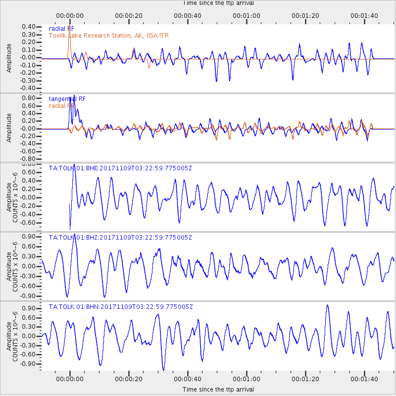
TOLK Toolik Lake Research Station, AK, USA - Earthquake Result Viewer
*The percent match for this event was below the threshold and hence no stack was calculated.
| Earthquake location: |
Halmahera, Indonesia |
| Earthquake latitude/longitude: |
1.9/127.1 |
| Earthquake time(UTC): |
2017/11/09 (313) 03:11:02 GMT |
| Earthquake Depth: |
99 km |
| Earthquake Magnitude: |
5.2 Mww |
| Earthquake Catalog/Contributor: |
NEIC PDE/us |
|
| Network: |
TA USArray Transportable Network (new EarthScope stations) |
| Station: |
TOLK Toolik Lake Research Station, AK, USA |
| Lat/Lon: |
68.64 N/149.57 W |
| Elevation: |
760 m |
|
| Distance: |
85.8 deg |
| Az: |
21.398 deg |
| Baz: |
264.48 deg |
| Ray Param: |
$rayparam |
*The percent match for this event was below the threshold and hence was not used in the summary stack. |
|
| Radial Match: |
52.409203 % |
| Radial Bump: |
400 |
| Transverse Match: |
77.82702 % |
| Transverse Bump: |
400 |
| SOD ConfigId: |
2429771 |
| Insert Time: |
2017-11-23 03:12:51.616 +0000 |
| GWidth: |
2.5 |
| Max Bumps: |
400 |
| Tol: |
0.001 |
|
Signal To Noise
| Channel | StoN | STA | LTA |
| TA:TOLK:01:BHZ:20171109T03:22:59.775005Z | 1.8096244 | 5.959227E-7 | 3.2930737E-7 |
| TA:TOLK:01:BHN:20171109T03:22:59.775005Z | 1.2767402 | 4.5257337E-7 | 3.544757E-7 |
| TA:TOLK:01:BHE:20171109T03:22:59.775005Z | 0.5383414 | 1.5169589E-7 | 2.817838E-7 |
| Arrivals |
| Ps | |
| PpPs | |
| PsPs/PpSs | |


