TIRR GEOFON Station Tirgusor, Romania - Earthquake Result Viewer
Earthquake location: Central Mid-Atlantic Ridge
Earthquake latitude/longitude: 7.3/-34.9
Earthquake time(UTC): 2008/05/23 (144) 19:35:34 GMT
Earthquake Depth: 9.0 km
Earthquake Magnitude: 6.0 MB, 6.4 MS, 6.5 MW, 6.5 MW
Earthquake Catalog/Contributor: WHDF/NEIC
Network: GE GEOFON
Station: TIRR GEOFON Station Tirgusor, Romania
Lat/Lon: 44.46 N/28.41 E
Elevation: 77 m
Distance: 66.0 deg
Az: 44.472 deg
Baz: 256.032 deg
Ray Param: 0.057929456
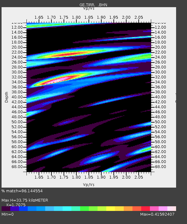
Estimated Moho Depth: 33.75 km
Estimated Crust Vp/Vs: 1.71
Assumed Crust Vp: 6.12 km/s
Estimated Crust Vs: 3.584 km/s
Estimated Crust Poisson's Ratio: 0.24
Radial Match: 96.144554 %
Radial Bump: 345
Transverse Match: 85.6488 %
Transverse Bump: 400
SOD ConfigId: 2504
Insert Time: 2010-03-09 07:05:02.922 +0000
GWidth: 2.5
Max Bumps: 400
Tol: 0.001

Signal To Noise

ChannelStoNSTALTA
GE:TIRR: :BHN:20080523T19:45:50.239011Z13.7972869.51043E-76.8929715E-8
GE:TIRR: :BHE:20080523T19:45:50.249021Z1.94028717.3131545E-83.769109E-8
GE:TIRR: :BHZ:20080523T19:45:50.21002Z8.372034.559936E-75.446631E-8
Arrivals
Ps4.1 SECOND
PpPs14 SECOND
PsPs/PpSs18 SECOND