You are here: Home > Network List > US - United States National Seismic Network Stations List
> Station MSO Missoula, Montana, USA > Earthquake Result Viewer
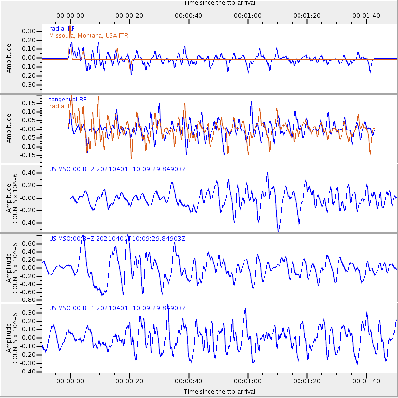
MSO Missoula, Montana, USA - Earthquake Result Viewer
*The percent match for this event was below the threshold and hence no stack was calculated.
| Earthquake location: |
Kermadec Islands, New Zealand |
| Earthquake latitude/longitude: |
-30.0/-177.7 |
| Earthquake time(UTC): |
2021/04/01 (091) 09:56:36 GMT |
| Earthquake Depth: |
10 km |
| Earthquake Magnitude: |
6.3 Mww |
| Earthquake Catalog/Contributor: |
NEIC PDE/us |
|
| Network: |
US United States National Seismic Network |
| Station: |
MSO Missoula, Montana, USA |
| Lat/Lon: |
46.83 N/113.94 W |
| Elevation: |
1264 m |
|
| Distance: |
95.6 deg |
| Az: |
38.227 deg |
| Baz: |
231.438 deg |
| Ray Param: |
$rayparam |
*The percent match for this event was below the threshold and hence was not used in the summary stack. |
|
| Radial Match: |
68.508224 % |
| Radial Bump: |
400 |
| Transverse Match: |
52.889935 % |
| Transverse Bump: |
400 |
| SOD ConfigId: |
24334971 |
| Insert Time: |
2021-04-15 10:14:35.880 +0000 |
| GWidth: |
2.5 |
| Max Bumps: |
400 |
| Tol: |
0.001 |
|
Signal To Noise
| Channel | StoN | STA | LTA |
| US:MSO:00:BHZ:20210401T10:09:29.84903Z | 2.9487526 | 3.7736226E-7 | 1.2797352E-7 |
| US:MSO:00:BH1:20210401T10:09:29.84903Z | 0.37504128 | 4.3579792E-8 | 1.16199985E-7 |
| US:MSO:00:BH2:20210401T10:09:29.84903Z | 1.533017 | 1.1927737E-7 | 7.7805645E-8 |
| Arrivals |
| Ps | |
| PpPs | |
| PsPs/PpSs | |


