You are here: Home > Network List > US - United States National Seismic Network Stations List
> Station CBKS Cedar Bluff, Kansas, USA > Earthquake Result Viewer
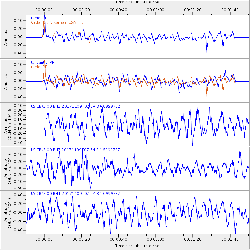
CBKS Cedar Bluff, Kansas, USA - Earthquake Result Viewer
*The percent match for this event was below the threshold and hence no stack was calculated.
| Earthquake location: |
Southeast Of Honshu, Japan |
| Earthquake latitude/longitude: |
32.5/141.4 |
| Earthquake time(UTC): |
2017/11/09 (313) 07:42:12 GMT |
| Earthquake Depth: |
20 km |
| Earthquake Magnitude: |
6.0 Mww |
| Earthquake Catalog/Contributor: |
NEIC PDE/us |
|
| Network: |
US United States National Seismic Network |
| Station: |
CBKS Cedar Bluff, Kansas, USA |
| Lat/Lon: |
38.81 N/99.74 W |
| Elevation: |
677 m |
|
| Distance: |
89.1 deg |
| Az: |
43.203 deg |
| Baz: |
312.253 deg |
| Ray Param: |
$rayparam |
*The percent match for this event was below the threshold and hence was not used in the summary stack. |
|
| Radial Match: |
49.655388 % |
| Radial Bump: |
400 |
| Transverse Match: |
45.306915 % |
| Transverse Bump: |
400 |
| SOD ConfigId: |
2429771 |
| Insert Time: |
2017-11-23 07:46:02.043 +0000 |
| GWidth: |
2.5 |
| Max Bumps: |
400 |
| Tol: |
0.001 |
|
Signal To Noise
| Channel | StoN | STA | LTA |
| US:CBKS:00:BHZ:20171109T07:54:34.699973Z | 2.2112112 | 2.2604432E-7 | 1.0222647E-7 |
| US:CBKS:00:BH1:20171109T07:54:34.699973Z | 1.1723226 | 1.760086E-7 | 1.5013666E-7 |
| US:CBKS:00:BH2:20171109T07:54:34.699973Z | 1.154339 | 1.9796246E-7 | 1.7149424E-7 |
| Arrivals |
| Ps | |
| PpPs | |
| PsPs/PpSs | |


