You are here: Home > Network List > II - Global Seismograph Network (GSN - IRIS/IDA) Stations List
> Station WRAB Tennant Creek, NT, Australia > Earthquake Result Viewer
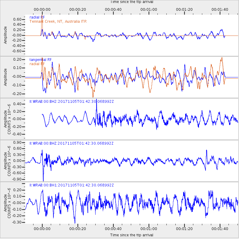
WRAB Tennant Creek, NT, Australia - Earthquake Result Viewer
*The percent match for this event was below the threshold and hence no stack was calculated.
| Earthquake location: |
Fiji Islands Region |
| Earthquake latitude/longitude: |
-18.6/-177.7 |
| Earthquake time(UTC): |
2017/11/05 (309) 01:35:28 GMT |
| Earthquake Depth: |
483 km |
| Earthquake Magnitude: |
5.5 Mww |
| Earthquake Catalog/Contributor: |
NEIC PDE/us |
|
| Network: |
II Global Seismograph Network (GSN - IRIS/IDA) |
| Station: |
WRAB Tennant Creek, NT, Australia |
| Lat/Lon: |
19.93 S/134.36 E |
| Elevation: |
366 m |
|
| Distance: |
45.1 deg |
| Az: |
260.179 deg |
| Baz: |
96.777 deg |
| Ray Param: |
$rayparam |
*The percent match for this event was below the threshold and hence was not used in the summary stack. |
|
| Radial Match: |
52.99979 % |
| Radial Bump: |
400 |
| Transverse Match: |
50.83352 % |
| Transverse Bump: |
400 |
| SOD ConfigId: |
2429771 |
| Insert Time: |
2017-11-24 01:33:08.192 +0000 |
| GWidth: |
2.5 |
| Max Bumps: |
400 |
| Tol: |
0.001 |
|
Signal To Noise
| Channel | StoN | STA | LTA |
| II:WRAB:00:BHZ:20171105T01:42:30.068992Z | 2.5960536 | 2.9756222E-7 | 1.1462098E-7 |
| II:WRAB:00:BH1:20171105T01:42:30.068992Z | 1.8680973 | 1.1272911E-7 | 6.034435E-8 |
| II:WRAB:00:BH2:20171105T01:42:30.068992Z | 1.65304 | 1.4892565E-7 | 9.009197E-8 |
| Arrivals |
| Ps | |
| PpPs | |
| PsPs/PpSs | |


