You are here: Home > Network List > IU - Global Seismograph Network (GSN - IRIS/USGS) Stations List
> Station CTAO Charters Towers, Australia > Earthquake Result Viewer
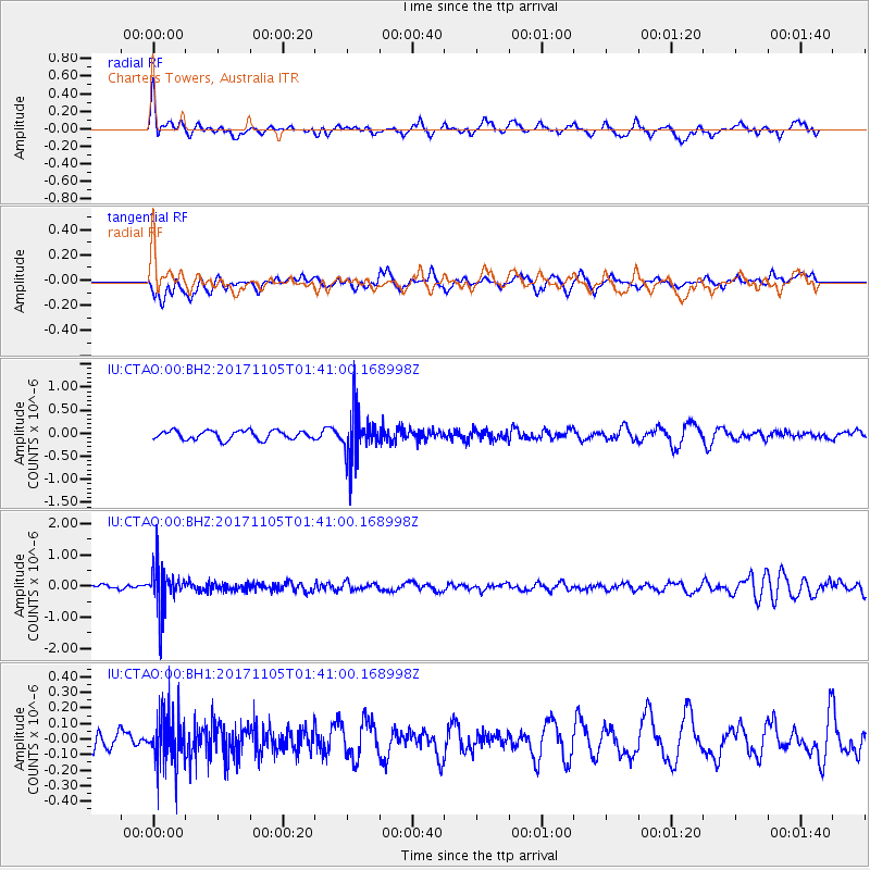
CTAO Charters Towers, Australia - Earthquake Result Viewer
*The percent match for this event was below the threshold and hence no stack was calculated.
| Earthquake location: |
Fiji Islands Region |
| Earthquake latitude/longitude: |
-18.6/-177.7 |
| Earthquake time(UTC): |
2017/11/05 (309) 01:35:28 GMT |
| Earthquake Depth: |
483 km |
| Earthquake Magnitude: |
5.5 Mww |
| Earthquake Catalog/Contributor: |
NEIC PDE/us |
|
| Network: |
IU Global Seismograph Network (GSN - IRIS/USGS) |
| Station: |
CTAO Charters Towers, Australia |
| Lat/Lon: |
20.09 S/146.25 E |
| Elevation: |
357 m |
|
| Distance: |
34.0 deg |
| Az: |
261.554 deg |
| Baz: |
93.783 deg |
| Ray Param: |
$rayparam |
*The percent match for this event was below the threshold and hence was not used in the summary stack. |
|
| Radial Match: |
49.029602 % |
| Radial Bump: |
333 |
| Transverse Match: |
53.444466 % |
| Transverse Bump: |
400 |
| SOD ConfigId: |
2429771 |
| Insert Time: |
2017-11-24 01:33:15.898 +0000 |
| GWidth: |
2.5 |
| Max Bumps: |
400 |
| Tol: |
0.001 |
|
Signal To Noise
| Channel | StoN | STA | LTA |
| IU:CTAO:00:BHZ:20171105T01:41:00.168998Z | 9.096746 | 7.1724895E-7 | 7.884676E-8 |
| IU:CTAO:00:BH1:20171105T01:41:00.168998Z | 2.8689232 | 1.7227417E-7 | 6.004837E-8 |
| IU:CTAO:00:BH2:20171105T01:41:00.168998Z | 5.4069004 | 5.16671E-7 | 9.55577E-8 |
| Arrivals |
| Ps | |
| PpPs | |
| PsPs/PpSs | |


