You are here: Home > Network List > TA - USArray Transportable Network (new EarthScope stations) Stations List
> Station F26K Sheenjek River, AK, USA > Earthquake Result Viewer
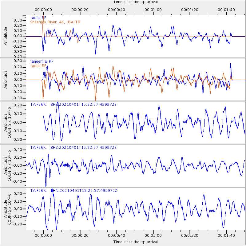
F26K Sheenjek River, AK, USA - Earthquake Result Viewer
*The percent match for this event was below the threshold and hence no stack was calculated.
| Earthquake location: |
Fiji Islands Region |
| Earthquake latitude/longitude: |
-21.9/-179.3 |
| Earthquake time(UTC): |
2021/04/01 (091) 15:11:18 GMT |
| Earthquake Depth: |
598 km |
| Earthquake Magnitude: |
6.0 mww |
| Earthquake Catalog/Contributor: |
NEIC PDE/us |
|
| Network: |
TA USArray Transportable Network (new EarthScope stations) |
| Station: |
F26K Sheenjek River, AK, USA |
| Lat/Lon: |
67.69 N/144.15 W |
| Elevation: |
683 m |
|
| Distance: |
93.0 deg |
| Az: |
12.728 deg |
| Baz: |
212.42 deg |
| Ray Param: |
$rayparam |
*The percent match for this event was below the threshold and hence was not used in the summary stack. |
|
| Radial Match: |
42.053303 % |
| Radial Bump: |
400 |
| Transverse Match: |
60.235783 % |
| Transverse Bump: |
400 |
| SOD ConfigId: |
24334971 |
| Insert Time: |
2021-04-15 15:27:56.514 +0000 |
| GWidth: |
2.5 |
| Max Bumps: |
400 |
| Tol: |
0.001 |
|
Signal To Noise
| Channel | StoN | STA | LTA |
| TA:F26K: :BHZ:20210401T15:22:57.499972Z | 3.327237 | 2.0549572E-7 | 6.1761675E-8 |
| TA:F26K: :BHN:20210401T15:22:57.499972Z | 2.2350094 | 1.701976E-7 | 7.615073E-8 |
| TA:F26K: :BHE:20210401T15:22:57.499972Z | 0.76862067 | 7.391354E-8 | 9.616387E-8 |
| Arrivals |
| Ps | |
| PpPs | |
| PsPs/PpSs | |


