You are here: Home > Network List > TA - USArray Transportable Network (new EarthScope stations) Stations List
> Station G16K Koyuk River, AK, USA > Earthquake Result Viewer
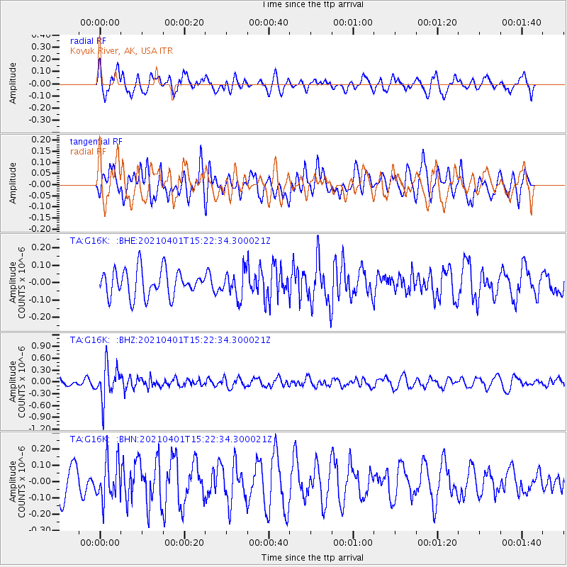
G16K Koyuk River, AK, USA - Earthquake Result Viewer
*The percent match for this event was below the threshold and hence no stack was calculated.
| Earthquake location: |
Fiji Islands Region |
| Earthquake latitude/longitude: |
-21.9/-179.3 |
| Earthquake time(UTC): |
2021/04/01 (091) 15:11:18 GMT |
| Earthquake Depth: |
598 km |
| Earthquake Magnitude: |
6.0 mww |
| Earthquake Catalog/Contributor: |
NEIC PDE/us |
|
| Network: |
TA USArray Transportable Network (new EarthScope stations) |
| Station: |
G16K Koyuk River, AK, USA |
| Lat/Lon: |
65.39 N/162.35 W |
| Elevation: |
169 m |
|
| Distance: |
88.0 deg |
| Az: |
7.031 deg |
| Baz: |
195.756 deg |
| Ray Param: |
$rayparam |
*The percent match for this event was below the threshold and hence was not used in the summary stack. |
|
| Radial Match: |
44.895805 % |
| Radial Bump: |
400 |
| Transverse Match: |
52.86321 % |
| Transverse Bump: |
400 |
| SOD ConfigId: |
24334971 |
| Insert Time: |
2021-04-15 15:28:00.631 +0000 |
| GWidth: |
2.5 |
| Max Bumps: |
400 |
| Tol: |
0.001 |
|
Signal To Noise
| Channel | StoN | STA | LTA |
| TA:G16K: :BHZ:20210401T15:22:34.300021Z | 5.3751183 | 4.3741787E-7 | 8.137828E-8 |
| TA:G16K: :BHN:20210401T15:22:34.300021Z | 1.6255208 | 1.242104E-7 | 7.641268E-8 |
| TA:G16K: :BHE:20210401T15:22:34.300021Z | 1.0126256 | 7.75421E-8 | 7.65753E-8 |
| Arrivals |
| Ps | |
| PpPs | |
| PsPs/PpSs | |


