You are here: Home > Network List > TA - USArray Transportable Network (new EarthScope stations) Stations List
> Station G31M Satah River, YT, CAN > Earthquake Result Viewer
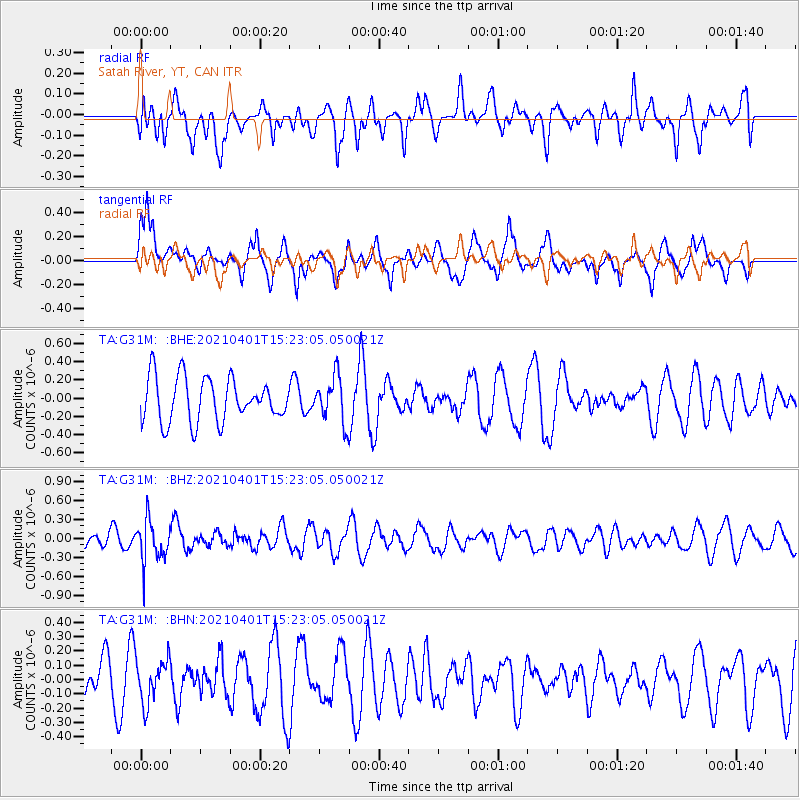
G31M Satah River, YT, CAN - Earthquake Result Viewer
*The percent match for this event was below the threshold and hence no stack was calculated.
| Earthquake location: |
Fiji Islands Region |
| Earthquake latitude/longitude: |
-21.9/-179.3 |
| Earthquake time(UTC): |
2021/04/01 (091) 15:11:18 GMT |
| Earthquake Depth: |
598 km |
| Earthquake Magnitude: |
6.0 mww |
| Earthquake Catalog/Contributor: |
NEIC PDE/us |
|
| Network: |
TA USArray Transportable Network (new EarthScope stations) |
| Station: |
G31M Satah River, YT, CAN |
| Lat/Lon: |
66.92 N/134.27 W |
| Elevation: |
61 m |
|
| Distance: |
94.7 deg |
| Az: |
16.262 deg |
| Baz: |
221.287 deg |
| Ray Param: |
$rayparam |
*The percent match for this event was below the threshold and hence was not used in the summary stack. |
|
| Radial Match: |
61.991344 % |
| Radial Bump: |
400 |
| Transverse Match: |
66.676476 % |
| Transverse Bump: |
400 |
| SOD ConfigId: |
24334971 |
| Insert Time: |
2021-04-15 15:28:07.449 +0000 |
| GWidth: |
2.5 |
| Max Bumps: |
400 |
| Tol: |
0.001 |
|
Signal To Noise
| Channel | StoN | STA | LTA |
| TA:G31M: :BHZ:20210401T15:23:05.050021Z | 2.4978347 | 3.2966884E-7 | 1.3198185E-7 |
| TA:G31M: :BHN:20210401T15:23:05.050021Z | 1.0531018 | 1.4987238E-7 | 1.4231519E-7 |
| TA:G31M: :BHE:20210401T15:23:05.050021Z | 1.0385165 | 2.4900797E-7 | 2.3977276E-7 |
| Arrivals |
| Ps | |
| PpPs | |
| PsPs/PpSs | |


