You are here: Home > Network List > G - GEOSCOPE Stations List
> Station FOMA Nahampoana reservation, Fort Dauphin, Madagascar > Earthquake Result Viewer
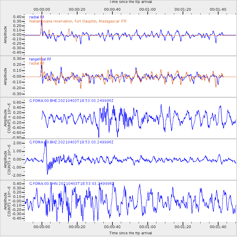
FOMA Nahampoana reservation, Fort Dauphin, Madagascar - Earthquake Result Viewer
*The percent match for this event was below the threshold and hence no stack was calculated.
| Earthquake location: |
Banda Sea |
| Earthquake latitude/longitude: |
-5.1/128.1 |
| Earthquake time(UTC): |
2021/04/03 (093) 18:42:01 GMT |
| Earthquake Depth: |
329 km |
| Earthquake Magnitude: |
5.9 Mww |
| Earthquake Catalog/Contributor: |
NEIC PDE/us |
|
| Network: |
G GEOSCOPE |
| Station: |
FOMA Nahampoana reservation, Fort Dauphin, Madagascar |
| Lat/Lon: |
24.98 S/46.98 E |
| Elevation: |
26 m |
|
| Distance: |
79.8 deg |
| Az: |
245.648 deg |
| Baz: |
90.926 deg |
| Ray Param: |
$rayparam |
*The percent match for this event was below the threshold and hence was not used in the summary stack. |
|
| Radial Match: |
72.5067 % |
| Radial Bump: |
400 |
| Transverse Match: |
61.698586 % |
| Transverse Bump: |
400 |
| SOD ConfigId: |
24334971 |
| Insert Time: |
2021-04-17 18:47:12.564 +0000 |
| GWidth: |
2.5 |
| Max Bumps: |
400 |
| Tol: |
0.001 |
|
Signal To Noise
| Channel | StoN | STA | LTA |
| G:FOMA:00:BHZ:20210403T18:53:03.249996Z | 5.7165456 | 1.1108781E-6 | 1.9432682E-7 |
| G:FOMA:00:BHN:20210403T18:53:03.249996Z | 1.000156 | 1.2635296E-7 | 1.2633325E-7 |
| G:FOMA:00:BHE:20210403T18:53:03.249996Z | 2.3061397 | 2.955737E-7 | 1.2816817E-7 |
| Arrivals |
| Ps | |
| PpPs | |
| PsPs/PpSs | |


