You are here: Home > Network List > TA - USArray Transportable Network (new EarthScope stations) Stations List
> Station I30M Mount Dempster, Yukon, CAN > Earthquake Result Viewer
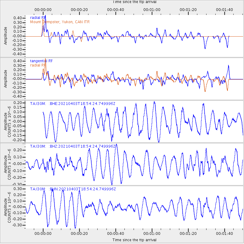
I30M Mount Dempster, Yukon, CAN - Earthquake Result Viewer
*The percent match for this event was below the threshold and hence no stack was calculated.
| Earthquake location: |
Banda Sea |
| Earthquake latitude/longitude: |
-5.1/128.1 |
| Earthquake time(UTC): |
2021/04/03 (093) 18:42:01 GMT |
| Earthquake Depth: |
329 km |
| Earthquake Magnitude: |
5.9 Mww |
| Earthquake Catalog/Contributor: |
NEIC PDE/us |
|
| Network: |
TA USArray Transportable Network (new EarthScope stations) |
| Station: |
I30M Mount Dempster, Yukon, CAN |
| Lat/Lon: |
65.22 N/136.38 W |
| Elevation: |
1399 m |
|
| Distance: |
96.9 deg |
| Az: |
24.996 deg |
| Baz: |
272.854 deg |
| Ray Param: |
$rayparam |
*The percent match for this event was below the threshold and hence was not used in the summary stack. |
|
| Radial Match: |
60.080307 % |
| Radial Bump: |
400 |
| Transverse Match: |
36.512527 % |
| Transverse Bump: |
375 |
| SOD ConfigId: |
24334971 |
| Insert Time: |
2021-04-17 18:50:09.290 +0000 |
| GWidth: |
2.5 |
| Max Bumps: |
400 |
| Tol: |
0.001 |
|
Signal To Noise
| Channel | StoN | STA | LTA |
| TA:I30M: :BHZ:20210403T18:54:24.749996Z | 0.7196261 | 5.629912E-8 | 7.8233846E-8 |
| TA:I30M: :BHN:20210403T18:54:24.749996Z | 3.690922 | 1.9993246E-7 | 5.41687E-8 |
| TA:I30M: :BHE:20210403T18:54:24.749996Z | 0.56564325 | 5.3108582E-8 | 9.389059E-8 |
| Arrivals |
| Ps | |
| PpPs | |
| PsPs/PpSs | |


