You are here: Home > Network List > TA - USArray Transportable Network (new EarthScope stations) Stations List
> Station D23K Nanushuk River, AK USA > Earthquake Result Viewer
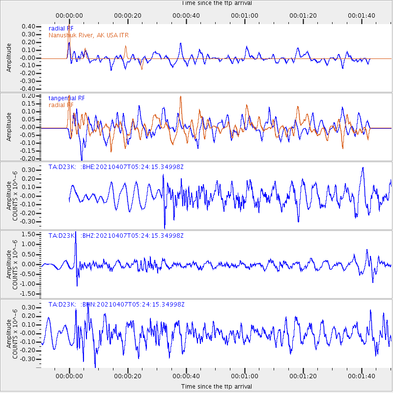
D23K Nanushuk River, AK USA - Earthquake Result Viewer
*The percent match for this event was below the threshold and hence no stack was calculated.
| Earthquake location: |
New Ireland Region, P.N.G. |
| Earthquake latitude/longitude: |
-3.6/154.0 |
| Earthquake time(UTC): |
2021/04/07 (097) 05:13:16 GMT |
| Earthquake Depth: |
448 km |
| Earthquake Magnitude: |
5.6 mww |
| Earthquake Catalog/Contributor: |
NEIC PDE/us |
|
| Network: |
TA USArray Transportable Network (new EarthScope stations) |
| Station: |
D23K Nanushuk River, AK USA |
| Lat/Lon: |
68.97 N/150.68 W |
| Elevation: |
406 m |
|
| Distance: |
81.6 deg |
| Az: |
17.468 deg |
| Baz: |
236.076 deg |
| Ray Param: |
$rayparam |
*The percent match for this event was below the threshold and hence was not used in the summary stack. |
|
| Radial Match: |
48.84035 % |
| Radial Bump: |
360 |
| Transverse Match: |
65.10315 % |
| Transverse Bump: |
400 |
| SOD ConfigId: |
24334971 |
| Insert Time: |
2021-04-21 05:27:05.240 +0000 |
| GWidth: |
2.5 |
| Max Bumps: |
400 |
| Tol: |
0.001 |
|
Signal To Noise
| Channel | StoN | STA | LTA |
| TA:D23K: :BHZ:20210407T05:24:15.34998Z | 5.122445 | 4.819412E-7 | 9.408421E-8 |
| TA:D23K: :BHN:20210407T05:24:15.34998Z | 1.4472272 | 1.243339E-7 | 8.59118E-8 |
| TA:D23K: :BHE:20210407T05:24:15.34998Z | 1.450591 | 1.2114711E-7 | 8.3515694E-8 |
| Arrivals |
| Ps | |
| PpPs | |
| PsPs/PpSs | |


