You are here: Home > Network List > TA - USArray Transportable Network (new EarthScope stations) Stations List
> Station I17K Unalakleet, AK, USA > Earthquake Result Viewer
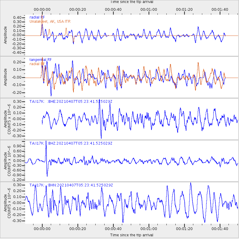
I17K Unalakleet, AK, USA - Earthquake Result Viewer
*The percent match for this event was below the threshold and hence no stack was calculated.
| Earthquake location: |
New Ireland Region, P.N.G. |
| Earthquake latitude/longitude: |
-3.6/154.0 |
| Earthquake time(UTC): |
2021/04/07 (097) 05:13:16 GMT |
| Earthquake Depth: |
448 km |
| Earthquake Magnitude: |
5.6 mww |
| Earthquake Catalog/Contributor: |
NEIC PDE/us |
|
| Network: |
TA USArray Transportable Network (new EarthScope stations) |
| Station: |
I17K Unalakleet, AK, USA |
| Lat/Lon: |
63.89 N/160.70 W |
| Elevation: |
105 m |
|
| Distance: |
75.3 deg |
| Az: |
18.987 deg |
| Baz: |
227.2 deg |
| Ray Param: |
$rayparam |
*The percent match for this event was below the threshold and hence was not used in the summary stack. |
|
| Radial Match: |
64.942924 % |
| Radial Bump: |
400 |
| Transverse Match: |
57.77235 % |
| Transverse Bump: |
400 |
| SOD ConfigId: |
24334971 |
| Insert Time: |
2021-04-21 05:27:46.037 +0000 |
| GWidth: |
2.5 |
| Max Bumps: |
400 |
| Tol: |
0.001 |
|
Signal To Noise
| Channel | StoN | STA | LTA |
| TA:I17K: :BHZ:20210407T05:23:41.525029Z | 3.9742684 | 4.1015758E-7 | 1.03203284E-7 |
| TA:I17K: :BHN:20210407T05:23:41.525029Z | 2.0450685 | 1.3290727E-7 | 6.498916E-8 |
| TA:I17K: :BHE:20210407T05:23:41.525029Z | 1.8382509 | 1.4327756E-7 | 7.794233E-8 |
| Arrivals |
| Ps | |
| PpPs | |
| PsPs/PpSs | |


