You are here: Home > Network List > IW - Intermountain West Stations List
> Station DLMT Dillon, Montana, USA > Earthquake Result Viewer
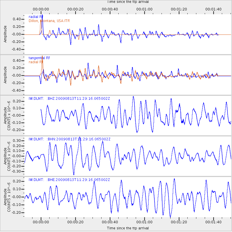
DLMT Dillon, Montana, USA - Earthquake Result Viewer
*The percent match for this event was below the threshold and hence no stack was calculated.
| Earthquake location: |
Tonga Islands |
| Earthquake latitude/longitude: |
-21.7/-174.6 |
| Earthquake time(UTC): |
2009/08/13 (225) 11:17:01 GMT |
| Earthquake Depth: |
10 km |
| Earthquake Magnitude: |
5.6 MW, 5.3 MB |
| Earthquake Catalog/Contributor: |
WHDF/NEIC |
|
| Network: |
IW Intermountain West |
| Station: |
DLMT Dillon, Montana, USA |
| Lat/Lon: |
45.36 N/112.60 W |
| Elevation: |
1569 m |
|
| Distance: |
87.3 deg |
| Az: |
38.537 deg |
| Baz: |
235.29 deg |
| Ray Param: |
$rayparam |
*The percent match for this event was below the threshold and hence was not used in the summary stack. |
|
| Radial Match: |
73.77639 % |
| Radial Bump: |
321 |
| Transverse Match: |
79.20909 % |
| Transverse Bump: |
400 |
| SOD ConfigId: |
2622 |
| Insert Time: |
2010-03-09 07:12:13.106 +0000 |
| GWidth: |
2.5 |
| Max Bumps: |
400 |
| Tol: |
0.001 |
|
Signal To Noise
| Channel | StoN | STA | LTA |
| IW:DLMT: :BHN:20090813T11:29:16.065002Z | 2.3412094 | 1.3409984E-7 | 5.7278015E-8 |
| IW:DLMT: :BHE:20090813T11:29:16.065002Z | 1.8047615 | 6.7713195E-8 | 3.751919E-8 |
| IW:DLMT: :BHZ:20090813T11:29:16.065002Z | 0.66855466 | 4.78786E-8 | 7.161509E-8 |
| Arrivals |
| Ps | |
| PpPs | |
| PsPs/PpSs | |


