You are here: Home > Network List > IW - Intermountain West Stations List
> Station DLMT Dillon, Montana, USA > Earthquake Result Viewer
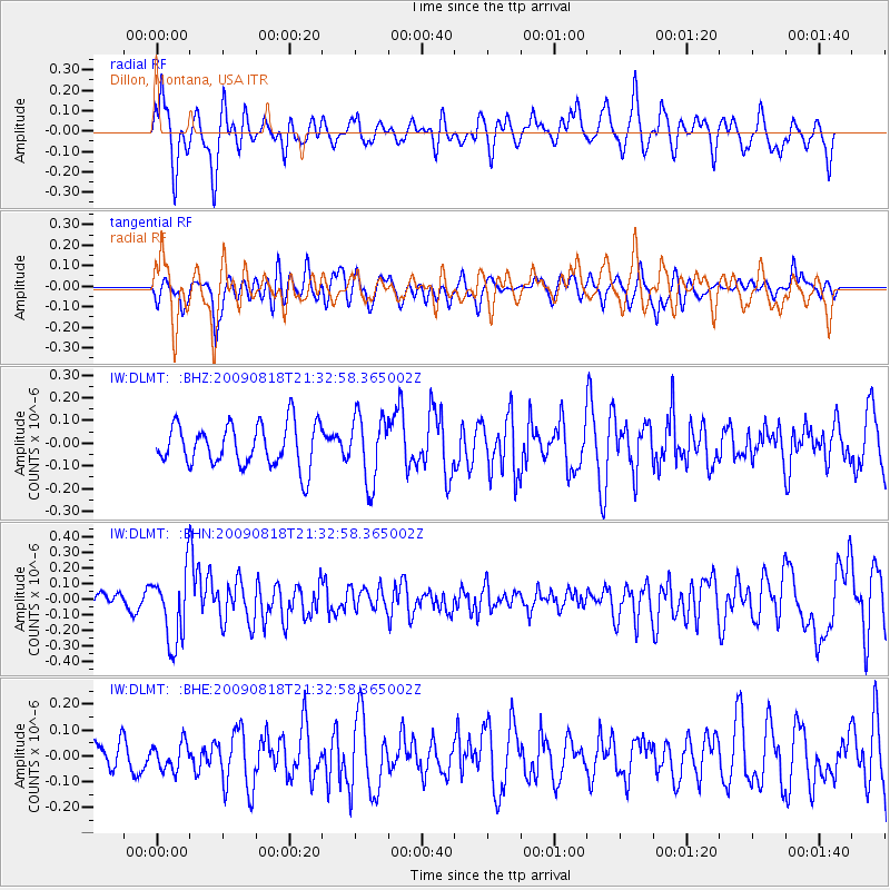
DLMT Dillon, Montana, USA - Earthquake Result Viewer
*The percent match for this event was below the threshold and hence no stack was calculated.
| Earthquake location: |
South Of Fiji Islands |
| Earthquake latitude/longitude: |
-26.1/-178.4 |
| Earthquake time(UTC): |
2009/08/18 (230) 21:20:47 GMT |
| Earthquake Depth: |
270 km |
| Earthquake Magnitude: |
5.5 MB, 6.3 MW, 6.3 MW |
| Earthquake Catalog/Contributor: |
WHDF/NEIC |
|
| Network: |
IW Intermountain West |
| Station: |
DLMT Dillon, Montana, USA |
| Lat/Lon: |
45.36 N/112.60 W |
| Elevation: |
1569 m |
|
| Distance: |
92.9 deg |
| Az: |
40.078 deg |
| Baz: |
235.226 deg |
| Ray Param: |
$rayparam |
*The percent match for this event was below the threshold and hence was not used in the summary stack. |
|
| Radial Match: |
53.0745 % |
| Radial Bump: |
400 |
| Transverse Match: |
60.632946 % |
| Transverse Bump: |
400 |
| SOD ConfigId: |
2622 |
| Insert Time: |
2010-03-09 07:12:20.707 +0000 |
| GWidth: |
2.5 |
| Max Bumps: |
400 |
| Tol: |
0.001 |
|
Signal To Noise
| Channel | StoN | STA | LTA |
| IW:DLMT: :BHN:20090818T21:32:58.365002Z | 3.2611647 | 2.2827345E-7 | 6.999752E-8 |
| IW:DLMT: :BHE:20090818T21:32:58.365002Z | 0.663773 | 5.1619818E-8 | 7.7767275E-8 |
| IW:DLMT: :BHZ:20090818T21:32:58.365002Z | 1.5557108 | 1.4501266E-7 | 9.3213124E-8 |
| Arrivals |
| Ps | |
| PpPs | |
| PsPs/PpSs | |


