You are here: Home > Network List > IW - Intermountain West Stations List
> Station DLMT Dillon, Montana, USA > Earthquake Result Viewer
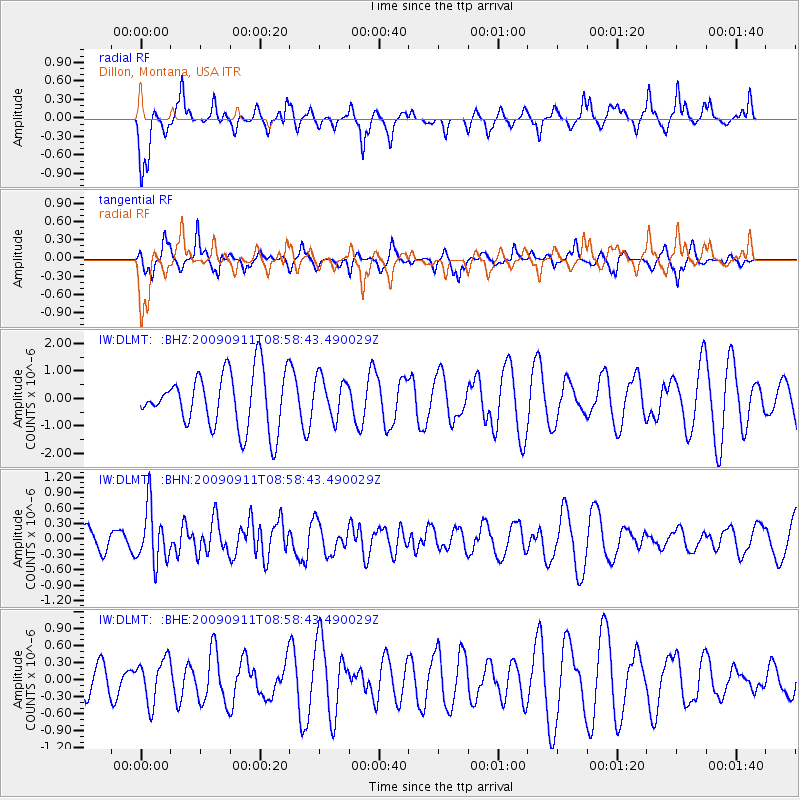
DLMT Dillon, Montana, USA - Earthquake Result Viewer
*The percent match for this event was below the threshold and hence no stack was calculated.
| Earthquake location: |
Kuril Islands |
| Earthquake latitude/longitude: |
48.3/154.2 |
| Earthquake time(UTC): |
2009/09/11 (254) 08:49:11 GMT |
| Earthquake Depth: |
35 km |
| Earthquake Magnitude: |
5.8 MB, 5.0 MS, 5.6 MW, 5.6 MW |
| Earthquake Catalog/Contributor: |
WHDF/NEIC |
|
| Network: |
IW Intermountain West |
| Station: |
DLMT Dillon, Montana, USA |
| Lat/Lon: |
45.36 N/112.60 W |
| Elevation: |
1569 m |
|
| Distance: |
59.9 deg |
| Az: |
54.47 deg |
| Baz: |
309.569 deg |
| Ray Param: |
$rayparam |
*The percent match for this event was below the threshold and hence was not used in the summary stack. |
|
| Radial Match: |
58.50783 % |
| Radial Bump: |
400 |
| Transverse Match: |
61.712265 % |
| Transverse Bump: |
295 |
| SOD ConfigId: |
2622 |
| Insert Time: |
2010-03-09 07:12:28.676 +0000 |
| GWidth: |
2.5 |
| Max Bumps: |
400 |
| Tol: |
0.001 |
|
Signal To Noise
| Channel | StoN | STA | LTA |
| IW:DLMT: :BHN:20090911T08:58:43.490029Z | 2.8065448 | 5.385609E-7 | 1.9189464E-7 |
| IW:DLMT: :BHE:20090911T08:58:43.490029Z | 0.6992721 | 3.8220224E-7 | 5.465715E-7 |
| IW:DLMT: :BHZ:20090911T08:58:43.490029Z | 0.73350066 | 7.385184E-7 | 1.0068408E-6 |
| Arrivals |
| Ps | |
| PpPs | |
| PsPs/PpSs | |


