You are here: Home > Network List > IW - Intermountain West Stations List
> Station DLMT Dillon, Montana, USA > Earthquake Result Viewer
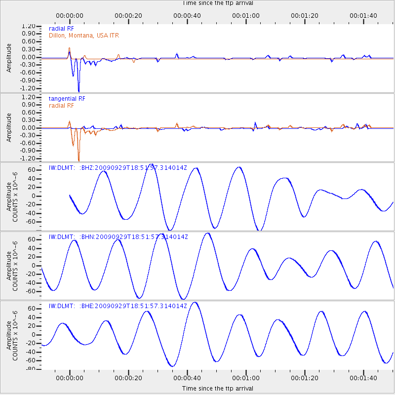
DLMT Dillon, Montana, USA - Earthquake Result Viewer
*The percent match for this event was below the threshold and hence no stack was calculated.
| Earthquake location: |
Tonga Islands |
| Earthquake latitude/longitude: |
-15.4/-173.2 |
| Earthquake time(UTC): |
2009/09/29 (272) 18:40:09 GMT |
| Earthquake Depth: |
2.3 km |
| Earthquake Magnitude: |
5.5 MB |
| Earthquake Catalog/Contributor: |
WHDF/NEIC |
|
| Network: |
IW Intermountain West |
| Station: |
DLMT Dillon, Montana, USA |
| Lat/Lon: |
45.36 N/112.60 W |
| Elevation: |
1569 m |
|
| Distance: |
81.6 deg |
| Az: |
38.403 deg |
| Baz: |
238.218 deg |
| Ray Param: |
$rayparam |
*The percent match for this event was below the threshold and hence was not used in the summary stack. |
|
| Radial Match: |
93.073235 % |
| Radial Bump: |
379 |
| Transverse Match: |
66.51629 % |
| Transverse Bump: |
338 |
| SOD ConfigId: |
2622 |
| Insert Time: |
2010-03-09 07:12:32.489 +0000 |
| GWidth: |
2.5 |
| Max Bumps: |
400 |
| Tol: |
0.001 |
|
Signal To Noise
| Channel | StoN | STA | LTA |
| IW:DLMT: :BHN:20090929T18:51:57.314014Z | 1.356344 | 4.6120156E-5 | 3.400329E-5 |
| IW:DLMT: :BHE:20090929T18:51:57.314014Z | 0.96586424 | 1.3857986E-5 | 1.4347758E-5 |
| IW:DLMT: :BHZ:20090929T18:51:57.314014Z | 1.4823558 | 5.1578998E-5 | 3.479529E-5 |
| Arrivals |
| Ps | |
| PpPs | |
| PsPs/PpSs | |


