You are here: Home > Network List > CI - Caltech Regional Seismic Network Stations List
> Station SMM Simmler, CA, USA > Earthquake Result Viewer
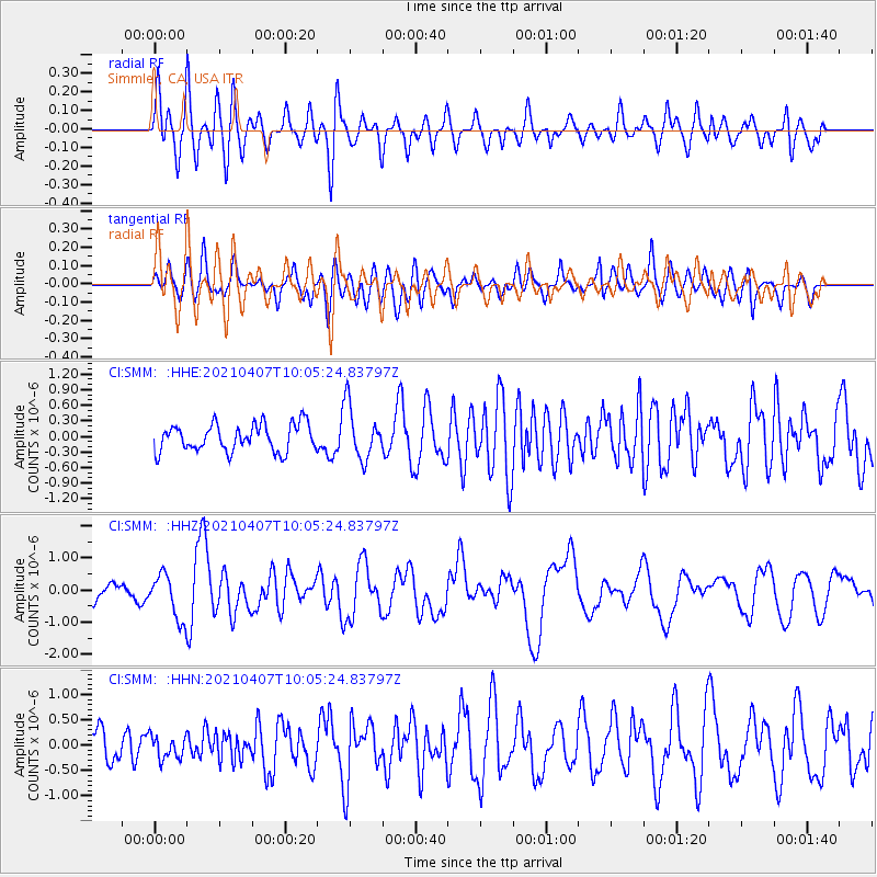
SMM Simmler, CA, USA - Earthquake Result Viewer
*The percent match for this event was below the threshold and hence no stack was calculated.
| Earthquake location: |
Kermadec Islands Region |
| Earthquake latitude/longitude: |
-29.1/-176.7 |
| Earthquake time(UTC): |
2021/04/07 (097) 09:53:28 GMT |
| Earthquake Depth: |
10 km |
| Earthquake Magnitude: |
6.0 Mww |
| Earthquake Catalog/Contributor: |
NEIC PDE/us |
|
| Network: |
CI Caltech Regional Seismic Network |
| Station: |
SMM Simmler, CA, USA |
| Lat/Lon: |
35.31 N/120.00 W |
| Elevation: |
599 m |
|
| Distance: |
83.4 deg |
| Az: |
43.464 deg |
| Baz: |
227.402 deg |
| Ray Param: |
$rayparam |
*The percent match for this event was below the threshold and hence was not used in the summary stack. |
|
| Radial Match: |
69.77498 % |
| Radial Bump: |
400 |
| Transverse Match: |
54.51562 % |
| Transverse Bump: |
400 |
| SOD ConfigId: |
24334971 |
| Insert Time: |
2021-04-21 10:03:05.743 +0000 |
| GWidth: |
2.5 |
| Max Bumps: |
400 |
| Tol: |
0.001 |
|
Signal To Noise
| Channel | StoN | STA | LTA |
| CI:SMM: :HHZ:20210407T10:05:24.83797Z | 2.6981783 | 6.983678E-7 | 2.5882937E-7 |
| CI:SMM: :HHN:20210407T10:05:24.83797Z | 0.7980051 | 2.2729718E-7 | 2.8483174E-7 |
| CI:SMM: :HHE:20210407T10:05:24.83797Z | 1.936633 | 5.0372563E-7 | 2.601038E-7 |
| Arrivals |
| Ps | |
| PpPs | |
| PsPs/PpSs | |


