You are here: Home > Network List > US - United States National Seismic Network Stations List
> Station AMTX Amarillo, Texas, USA > Earthquake Result Viewer
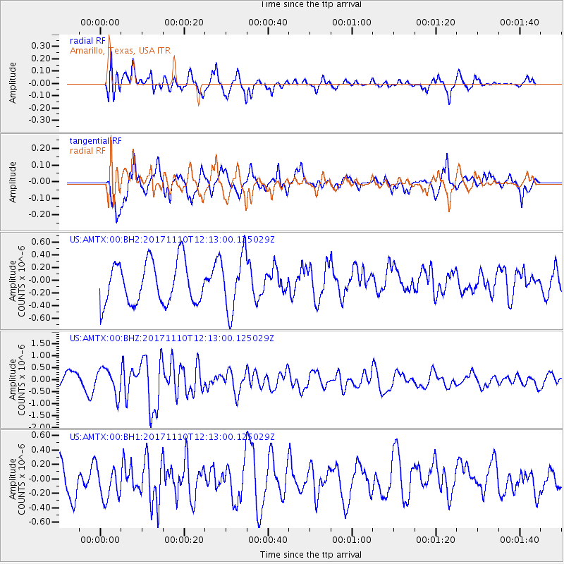
AMTX Amarillo, Texas, USA - Earthquake Result Viewer
*The percent match for this event was below the threshold and hence no stack was calculated.
| Earthquake location: |
West Chile Rise |
| Earthquake latitude/longitude: |
-41.5/-84.1 |
| Earthquake time(UTC): |
2017/11/10 (314) 12:01:34 GMT |
| Earthquake Depth: |
10 km |
| Earthquake Magnitude: |
5.8 Mww |
| Earthquake Catalog/Contributor: |
NEIC PDE/us |
|
| Network: |
US United States National Seismic Network |
| Station: |
AMTX Amarillo, Texas, USA |
| Lat/Lon: |
34.53 N/101.41 W |
| Elevation: |
1010 m |
|
| Distance: |
77.3 deg |
| Az: |
345.407 deg |
| Baz: |
166.745 deg |
| Ray Param: |
$rayparam |
*The percent match for this event was below the threshold and hence was not used in the summary stack. |
|
| Radial Match: |
57.223976 % |
| Radial Bump: |
400 |
| Transverse Match: |
67.66606 % |
| Transverse Bump: |
400 |
| SOD ConfigId: |
2429771 |
| Insert Time: |
2017-11-24 12:06:58.615 +0000 |
| GWidth: |
2.5 |
| Max Bumps: |
400 |
| Tol: |
0.001 |
|
Signal To Noise
| Channel | StoN | STA | LTA |
| US:AMTX:00:BHZ:20171110T12:13:00.125029Z | 1.3667138 | 5.490294E-7 | 4.0171497E-7 |
| US:AMTX:00:BH1:20171110T12:13:00.125029Z | 0.9437557 | 2.1072317E-7 | 2.232815E-7 |
| US:AMTX:00:BH2:20171110T12:13:00.125029Z | 1.2264696 | 4.0427574E-7 | 3.2962558E-7 |
| Arrivals |
| Ps | |
| PpPs | |
| PsPs/PpSs | |


