You are here: Home > Network List > IW - Intermountain West Stations List
> Station DLMT Dillon, Montana, USA > Earthquake Result Viewer
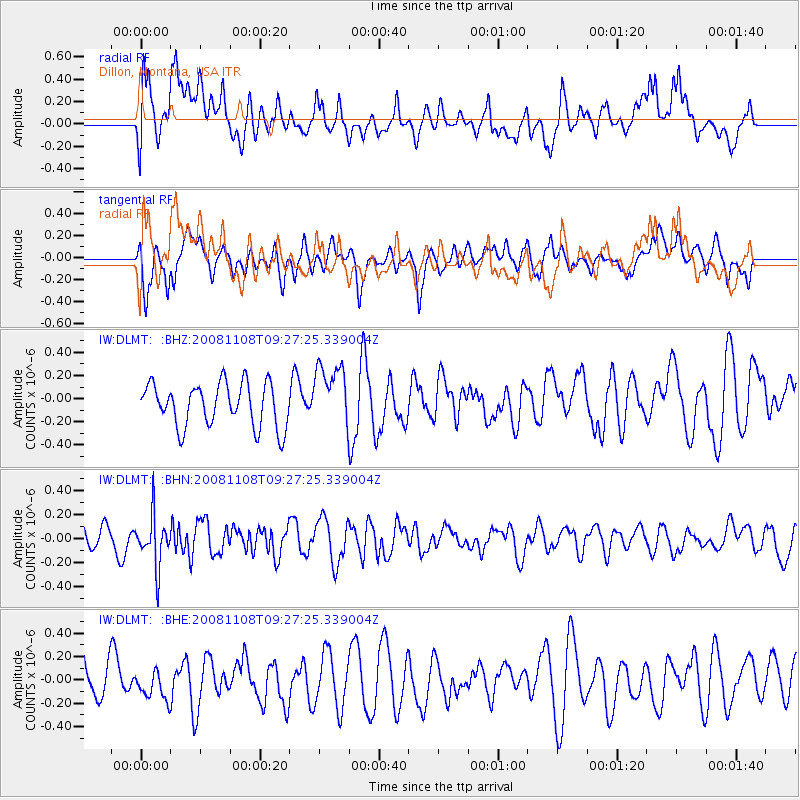
DLMT Dillon, Montana, USA - Earthquake Result Viewer
*The percent match for this event was below the threshold and hence no stack was calculated.
| Earthquake location: |
Tonga Islands |
| Earthquake latitude/longitude: |
-15.2/-174.2 |
| Earthquake time(UTC): |
2008/11/08 (313) 09:15:51 GMT |
| Earthquake Depth: |
140 km |
| Earthquake Magnitude: |
5.5 MW, 5.3 MB |
| Earthquake Catalog/Contributor: |
WHDF/NEIC |
|
| Network: |
IW Intermountain West |
| Station: |
DLMT Dillon, Montana, USA |
| Lat/Lon: |
45.36 N/112.60 W |
| Elevation: |
1569 m |
|
| Distance: |
82.0 deg |
| Az: |
38.776 deg |
| Baz: |
239.046 deg |
| Ray Param: |
$rayparam |
*The percent match for this event was below the threshold and hence was not used in the summary stack. |
|
| Radial Match: |
63.65013 % |
| Radial Bump: |
400 |
| Transverse Match: |
59.21711 % |
| Transverse Bump: |
400 |
| SOD ConfigId: |
2658 |
| Insert Time: |
2010-03-09 07:13:25.517 +0000 |
| GWidth: |
2.5 |
| Max Bumps: |
400 |
| Tol: |
0.001 |
|
Signal To Noise
| Channel | StoN | STA | LTA |
| IW:DLMT: :BHN:20081108T09:27:25.339004Z | 2.9094522 | 2.0764693E-7 | 7.1369776E-8 |
| IW:DLMT: :BHE:20081108T09:27:25.339004Z | 0.854443 | 1.2359327E-7 | 1.4464776E-7 |
| IW:DLMT: :BHZ:20081108T09:27:25.339004Z | 1.4760983 | 2.761223E-7 | 1.8706228E-7 |
| Arrivals |
| Ps | |
| PpPs | |
| PsPs/PpSs | |


