You are here: Home > Network List > IW - Intermountain West Stations List
> Station DLMT Dillon, Montana, USA > Earthquake Result Viewer
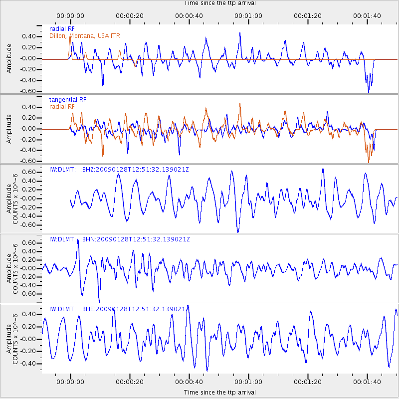
DLMT Dillon, Montana, USA - Earthquake Result Viewer
*The percent match for this event was below the threshold and hence no stack was calculated.
| Earthquake location: |
Samoa Islands Region |
| Earthquake latitude/longitude: |
-17.0/-172.1 |
| Earthquake time(UTC): |
2009/01/28 (028) 12:39:42 GMT |
| Earthquake Depth: |
10 km |
| Earthquake Magnitude: |
5.6 MB, 5.3 MS, 5.5 MW |
| Earthquake Catalog/Contributor: |
WHDF/NEIC |
|
| Network: |
IW Intermountain West |
| Station: |
DLMT Dillon, Montana, USA |
| Lat/Lon: |
45.36 N/112.60 W |
| Elevation: |
1569 m |
|
| Distance: |
82.1 deg |
| Az: |
37.81 deg |
| Baz: |
236.322 deg |
| Ray Param: |
$rayparam |
*The percent match for this event was below the threshold and hence was not used in the summary stack. |
|
| Radial Match: |
57.30171 % |
| Radial Bump: |
400 |
| Transverse Match: |
64.93036 % |
| Transverse Bump: |
400 |
| SOD ConfigId: |
2658 |
| Insert Time: |
2010-03-09 07:13:26.251 +0000 |
| GWidth: |
2.5 |
| Max Bumps: |
400 |
| Tol: |
0.001 |
|
Signal To Noise
| Channel | StoN | STA | LTA |
| IW:DLMT: :BHN:20090128T12:51:32.139021Z | 3.3744507 | 3.4707665E-7 | 1.02854266E-7 |
| IW:DLMT: :BHE:20090128T12:51:32.139021Z | 1.7336473 | 2.5179892E-7 | 1.452423E-7 |
| IW:DLMT: :BHZ:20090128T12:51:32.139021Z | 1.018528 | 2.5633506E-7 | 2.5167208E-7 |
| Arrivals |
| Ps | |
| PpPs | |
| PsPs/PpSs | |


