You are here: Home > Network List > IW - Intermountain West Stations List
> Station DLMT Dillon, Montana, USA > Earthquake Result Viewer
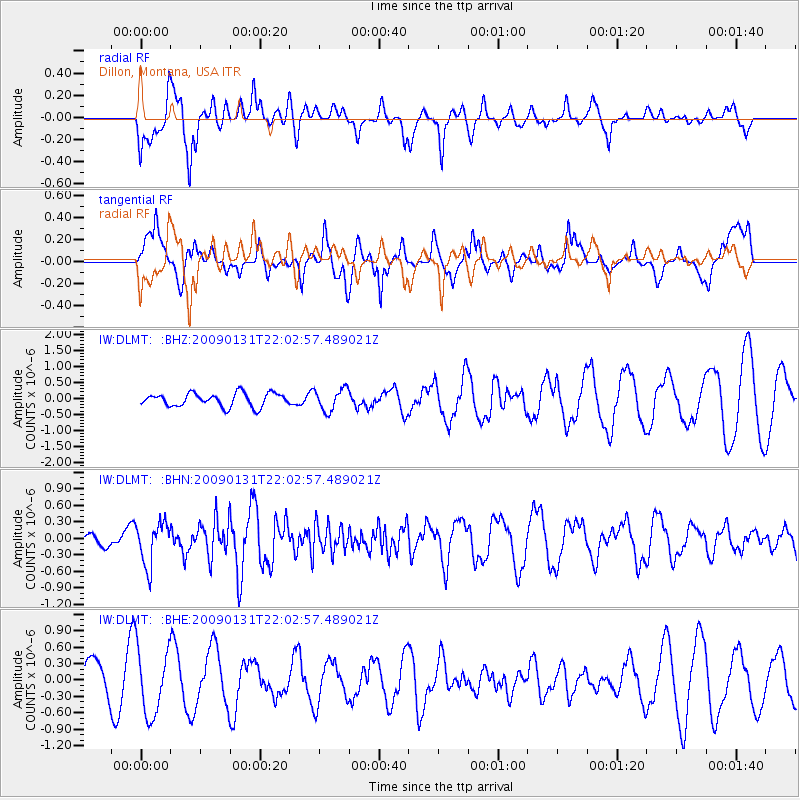
DLMT Dillon, Montana, USA - Earthquake Result Viewer
*The percent match for this event was below the threshold and hence no stack was calculated.
| Earthquake location: |
Near East Coast Of Honshu, Japan |
| Earthquake latitude/longitude: |
36.7/141.1 |
| Earthquake time(UTC): |
2009/01/31 (031) 21:51:52 GMT |
| Earthquake Depth: |
34 km |
| Earthquake Magnitude: |
5.6 MB, 5.3 MS, 5.8 MW, 5.7 MW |
| Earthquake Catalog/Contributor: |
WHDF/NEIC |
|
| Network: |
IW Intermountain West |
| Station: |
DLMT Dillon, Montana, USA |
| Lat/Lon: |
45.36 N/112.60 W |
| Elevation: |
1569 m |
|
| Distance: |
74.7 deg |
| Az: |
44.559 deg |
| Baz: |
306.902 deg |
| Ray Param: |
$rayparam |
*The percent match for this event was below the threshold and hence was not used in the summary stack. |
|
| Radial Match: |
77.77313 % |
| Radial Bump: |
400 |
| Transverse Match: |
54.015865 % |
| Transverse Bump: |
400 |
| SOD ConfigId: |
2658 |
| Insert Time: |
2010-03-09 07:13:31.521 +0000 |
| GWidth: |
2.5 |
| Max Bumps: |
400 |
| Tol: |
0.001 |
|
Signal To Noise
| Channel | StoN | STA | LTA |
| IW:DLMT: :BHN:20090131T22:02:57.489021Z | 3.583585 | 3.8703377E-7 | 1.0800183E-7 |
| IW:DLMT: :BHE:20090131T22:02:57.489021Z | 1.8095151 | 6.0875743E-7 | 3.364202E-7 |
| IW:DLMT: :BHZ:20090131T22:02:57.489021Z | 1.6699744 | 3.4757184E-7 | 2.0813003E-7 |
| Arrivals |
| Ps | |
| PpPs | |
| PsPs/PpSs | |


