You are here: Home > Network List > IW - Intermountain West Stations List
> Station DLMT Dillon, Montana, USA > Earthquake Result Viewer
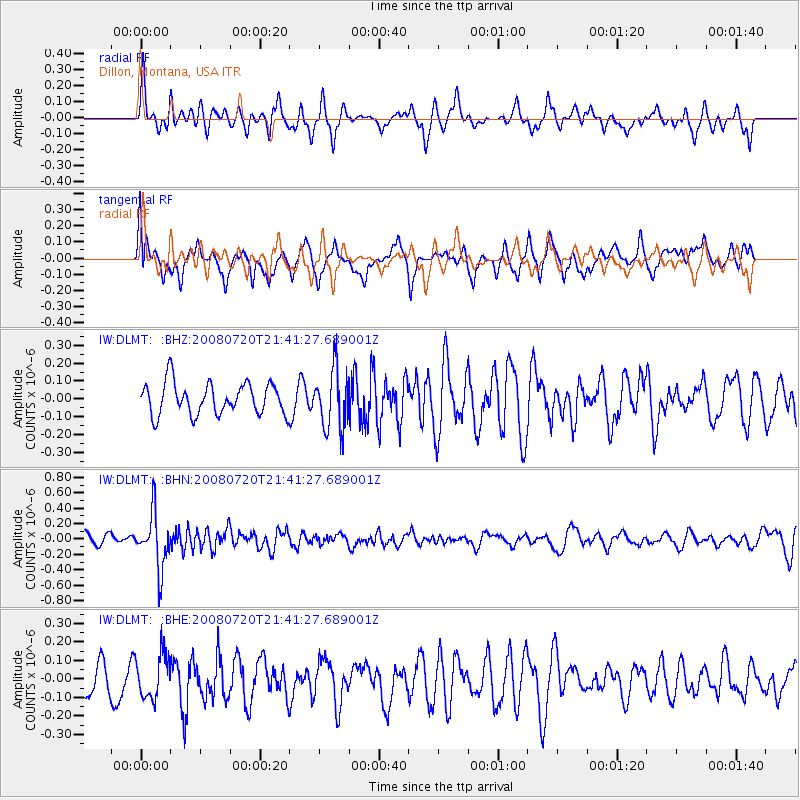
DLMT Dillon, Montana, USA - Earthquake Result Viewer
*The percent match for this event was below the threshold and hence no stack was calculated.
| Earthquake location: |
Bonin Islands, Japan Region |
| Earthquake latitude/longitude: |
27.8/139.6 |
| Earthquake time(UTC): |
2008/07/20 (202) 21:30:29 GMT |
| Earthquake Depth: |
481 km |
| Earthquake Magnitude: |
5.8 MW, 5.1 MB, 5.8 MW |
| Earthquake Catalog/Contributor: |
WHDF/NEIC |
|
| Network: |
IW Intermountain West |
| Station: |
DLMT Dillon, Montana, USA |
| Lat/Lon: |
45.36 N/112.60 W |
| Elevation: |
1569 m |
|
| Distance: |
82.1 deg |
| Az: |
42.67 deg |
| Baz: |
301.586 deg |
| Ray Param: |
$rayparam |
*The percent match for this event was below the threshold and hence was not used in the summary stack. |
|
| Radial Match: |
57.380943 % |
| Radial Bump: |
368 |
| Transverse Match: |
68.15005 % |
| Transverse Bump: |
400 |
| SOD ConfigId: |
2504 |
| Insert Time: |
2010-03-09 07:13:34.206 +0000 |
| GWidth: |
2.5 |
| Max Bumps: |
400 |
| Tol: |
0.001 |
|
Signal To Noise
| Channel | StoN | STA | LTA |
| IW:DLMT: :BHN:20080720T21:41:27.689001Z | 5.435409 | 3.568324E-7 | 6.5649594E-8 |
| IW:DLMT: :BHE:20080720T21:41:27.689001Z | 1.3423966 | 1.1801781E-7 | 8.791575E-8 |
| IW:DLMT: :BHZ:20080720T21:41:27.689001Z | 1.8757616 | 1.6536383E-7 | 8.815823E-8 |
| Arrivals |
| Ps | |
| PpPs | |
| PsPs/PpSs | |


