You are here: Home > Network List > TA - USArray Transportable Network (new EarthScope stations) Stations List
> Station L15K Ungalak Mountain, AK, USA > Earthquake Result Viewer
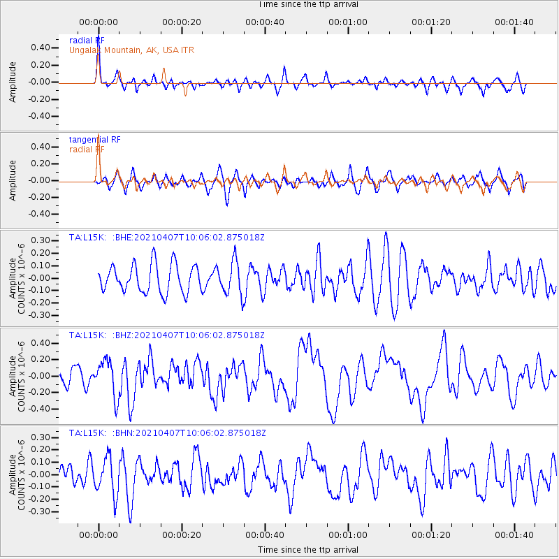
L15K Ungalak Mountain, AK, USA - Earthquake Result Viewer
*The percent match for this event was below the threshold and hence no stack was calculated.
| Earthquake location: |
Kermadec Islands Region |
| Earthquake latitude/longitude: |
-29.1/-176.7 |
| Earthquake time(UTC): |
2021/04/07 (097) 09:53:28 GMT |
| Earthquake Depth: |
10 km |
| Earthquake Magnitude: |
6.0 Mww |
| Earthquake Catalog/Contributor: |
NEIC PDE/us |
|
| Network: |
TA USArray Transportable Network (new EarthScope stations) |
| Station: |
L15K Ungalak Mountain, AK, USA |
| Lat/Lon: |
61.68 N/161.49 W |
| Elevation: |
219 m |
|
| Distance: |
91.3 deg |
| Az: |
7.178 deg |
| Baz: |
193.256 deg |
| Ray Param: |
$rayparam |
*The percent match for this event was below the threshold and hence was not used in the summary stack. |
|
| Radial Match: |
65.936646 % |
| Radial Bump: |
371 |
| Transverse Match: |
66.37388 % |
| Transverse Bump: |
400 |
| SOD ConfigId: |
24334971 |
| Insert Time: |
2021-04-21 10:09:53.688 +0000 |
| GWidth: |
2.5 |
| Max Bumps: |
400 |
| Tol: |
0.001 |
|
Signal To Noise
| Channel | StoN | STA | LTA |
| TA:L15K: :BHZ:20210407T10:06:02.875018Z | 2.5203369 | 2.2646975E-7 | 8.985694E-8 |
| TA:L15K: :BHN:20210407T10:06:02.875018Z | 1.1156311 | 1.5414328E-7 | 1.381669E-7 |
| TA:L15K: :BHE:20210407T10:06:02.875018Z | 1.2395442 | 1.3878689E-7 | 1.1196607E-7 |
| Arrivals |
| Ps | |
| PpPs | |
| PsPs/PpSs | |


