You are here: Home > Network List > IW - Intermountain West Stations List
> Station DLMT Dillon, Montana, USA > Earthquake Result Viewer
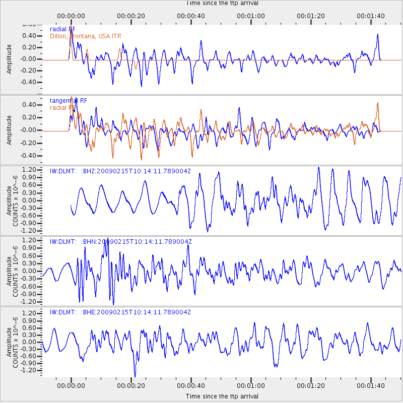
DLMT Dillon, Montana, USA - Earthquake Result Viewer
*The percent match for this event was below the threshold and hence no stack was calculated.
| Earthquake location: |
Near Coast Of Northern Peru |
| Earthquake latitude/longitude: |
-5.9/-80.9 |
| Earthquake time(UTC): |
2009/02/15 (046) 10:04:49 GMT |
| Earthquake Depth: |
21 km |
| Earthquake Magnitude: |
5.8 MB, 5.7 MS, 6.1 MW, 6.1 MW |
| Earthquake Catalog/Contributor: |
WHDF/NEIC |
|
| Network: |
IW Intermountain West |
| Station: |
DLMT Dillon, Montana, USA |
| Lat/Lon: |
45.36 N/112.60 W |
| Elevation: |
1569 m |
|
| Distance: |
58.3 deg |
| Az: |
334.196 deg |
| Baz: |
142.102 deg |
| Ray Param: |
$rayparam |
*The percent match for this event was below the threshold and hence was not used in the summary stack. |
|
| Radial Match: |
66.166374 % |
| Radial Bump: |
400 |
| Transverse Match: |
57.608006 % |
| Transverse Bump: |
400 |
| SOD ConfigId: |
2658 |
| Insert Time: |
2010-03-09 07:13:42.047 +0000 |
| GWidth: |
2.5 |
| Max Bumps: |
400 |
| Tol: |
0.001 |
|
Signal To Noise
| Channel | StoN | STA | LTA |
| IW:DLMT: :BHN:20090215T10:14:11.789004Z | 2.9996498 | 5.281708E-7 | 1.7607749E-7 |
| IW:DLMT: :BHE:20090215T10:14:11.789004Z | 0.86225194 | 4.5031328E-7 | 5.2225255E-7 |
| IW:DLMT: :BHZ:20090215T10:14:11.789004Z | 0.54222447 | 1.889096E-7 | 3.483974E-7 |
| Arrivals |
| Ps | |
| PpPs | |
| PsPs/PpSs | |


