You are here: Home > Network List > IW - Intermountain West Stations List
> Station DLMT Dillon, Montana, USA > Earthquake Result Viewer
DLMT Dillon, Montana, USA - Earthquake Result Viewer
*The percent match for this event was below the threshold and hence no stack was calculated.
| Earthquake location: |
Tonga Islands |
| Earthquake latitude/longitude: |
-16.8/-173.5 |
| Earthquake time(UTC): |
2009/05/17 (137) 06:23:03 GMT |
| Earthquake Depth: |
67 km |
| Earthquake Magnitude: |
5.5 MB, 5.6 MW, 5.6 MW |
| Earthquake Catalog/Contributor: |
WHDF/NEIC |
|
| Network: |
IW Intermountain West |
| Station: |
DLMT Dillon, Montana, USA |
| Lat/Lon: |
45.36 N/112.60 W |
| Elevation: |
1569 m |
|
| Distance: |
82.9 deg |
| Az: |
38.375 deg |
| Baz: |
237.495 deg |
| Ray Param: |
$rayparam |
*The percent match for this event was below the threshold and hence was not used in the summary stack. |
|
| Radial Match: |
51.5978 % |
| Radial Bump: |
400 |
| Transverse Match: |
54.590816 % |
| Transverse Bump: |
400 |
| SOD ConfigId: |
2760 |
| Insert Time: |
2010-03-09 07:13:44.935 +0000 |
| GWidth: |
2.5 |
| Max Bumps: |
400 |
| Tol: |
0.001 |
|
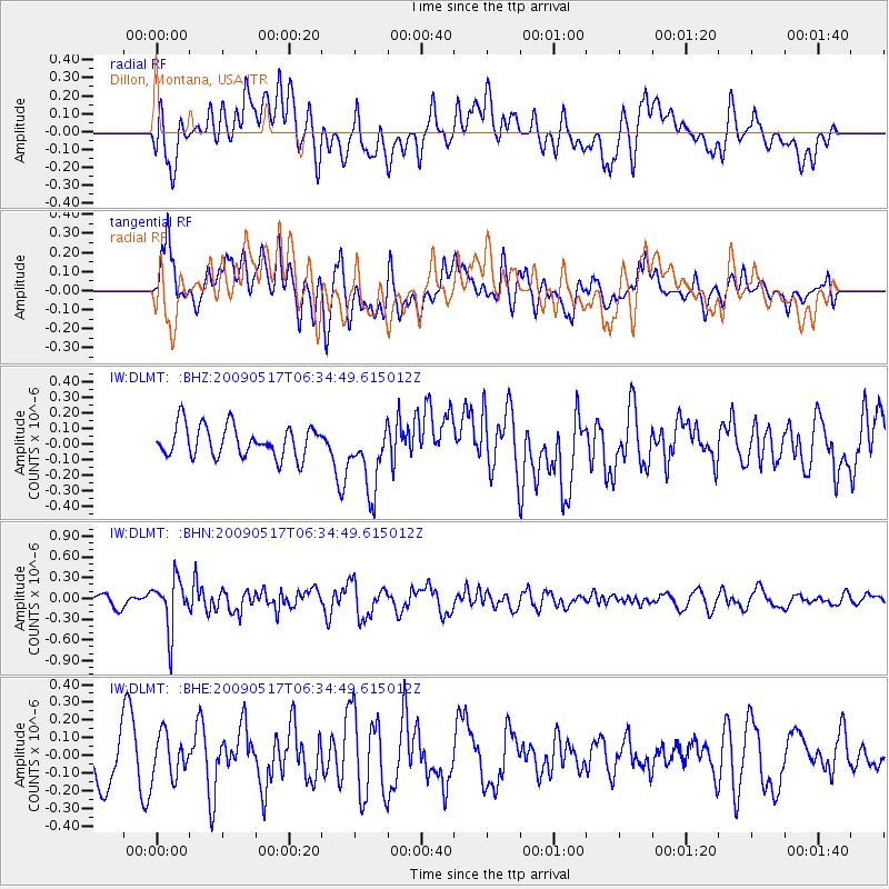
Signal To Noise
| Channel | StoN | STA | LTA |
| IW:DLMT: :BHN:20090517T06:34:49.615012Z | 3.6464891 | 3.6318878E-7 | 9.9599575E-8 |
| IW:DLMT: :BHE:20090517T06:34:49.615012Z | 0.79878914 | 1.1963978E-7 | 1.4977643E-7 |
| IW:DLMT: :BHZ:20090517T06:34:49.615012Z | 2.1948254 | 2.1855232E-7 | 9.957617E-8 |
| Arrivals |
| Ps | |
| PpPs | |
| PsPs/PpSs | |


