You are here: Home > Network List > US - United States National Seismic Network Stations List
> Station MSO Missoula, Montana, USA > Earthquake Result Viewer
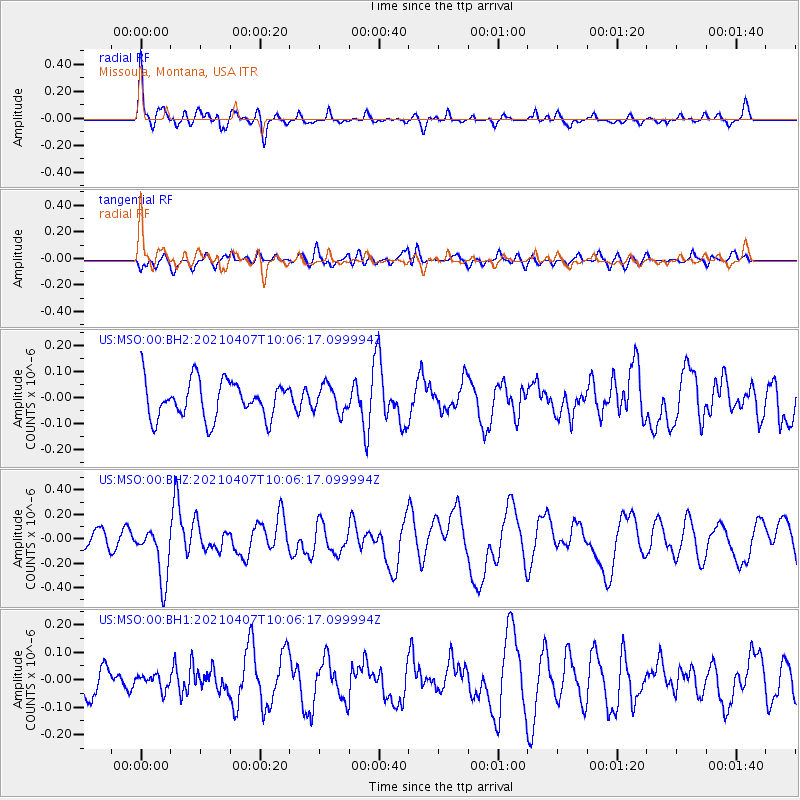
MSO Missoula, Montana, USA - Earthquake Result Viewer
*The percent match for this event was below the threshold and hence no stack was calculated.
| Earthquake location: |
Kermadec Islands Region |
| Earthquake latitude/longitude: |
-29.1/-176.7 |
| Earthquake time(UTC): |
2021/04/07 (097) 09:53:28 GMT |
| Earthquake Depth: |
10 km |
| Earthquake Magnitude: |
6.0 Mww |
| Earthquake Catalog/Contributor: |
NEIC PDE/us |
|
| Network: |
US United States National Seismic Network |
| Station: |
MSO Missoula, Montana, USA |
| Lat/Lon: |
46.83 N/113.94 W |
| Elevation: |
1264 m |
|
| Distance: |
94.4 deg |
| Az: |
37.742 deg |
| Baz: |
231.277 deg |
| Ray Param: |
$rayparam |
*The percent match for this event was below the threshold and hence was not used in the summary stack. |
|
| Radial Match: |
65.20705 % |
| Radial Bump: |
400 |
| Transverse Match: |
50.86456 % |
| Transverse Bump: |
400 |
| SOD ConfigId: |
24334971 |
| Insert Time: |
2021-04-21 10:12:46.194 +0000 |
| GWidth: |
2.5 |
| Max Bumps: |
400 |
| Tol: |
0.001 |
|
Signal To Noise
| Channel | StoN | STA | LTA |
| US:MSO:00:BHZ:20210407T10:06:17.099994Z | 2.2789793 | 2.2401346E-7 | 9.829553E-8 |
| US:MSO:00:BH1:20210407T10:06:17.099994Z | 0.4565879 | 2.6465223E-8 | 5.796304E-8 |
| US:MSO:00:BH2:20210407T10:06:17.099994Z | 0.7028873 | 5.063975E-8 | 7.2045324E-8 |
| Arrivals |
| Ps | |
| PpPs | |
| PsPs/PpSs | |


