You are here: Home > Network List > IW - Intermountain West Stations List
> Station DLMT Dillon, Montana, USA > Earthquake Result Viewer
DLMT Dillon, Montana, USA - Earthquake Result Viewer
*The percent match for this event was below the threshold and hence no stack was calculated.
| Earthquake location: |
Tonga Islands |
| Earthquake latitude/longitude: |
-18.4/-175.4 |
| Earthquake time(UTC): |
2008/10/22 (296) 12:55:57 GMT |
| Earthquake Depth: |
233 km |
| Earthquake Magnitude: |
5.9 MB, 6.4 MW, 6.3 MW |
| Earthquake Catalog/Contributor: |
WHDF/NEIC |
|
| Network: |
IW Intermountain West |
| Station: |
DLMT Dillon, Montana, USA |
| Lat/Lon: |
45.36 N/112.60 W |
| Elevation: |
1569 m |
|
| Distance: |
85.2 deg |
| Az: |
38.976 deg |
| Baz: |
237.895 deg |
| Ray Param: |
$rayparam |
*The percent match for this event was below the threshold and hence was not used in the summary stack. |
|
| Radial Match: |
50.679108 % |
| Radial Bump: |
321 |
| Transverse Match: |
60.48143 % |
| Transverse Bump: |
400 |
| SOD ConfigId: |
2556 |
| Insert Time: |
2010-03-09 07:14:10.422 +0000 |
| GWidth: |
2.5 |
| Max Bumps: |
400 |
| Tol: |
0.001 |
|
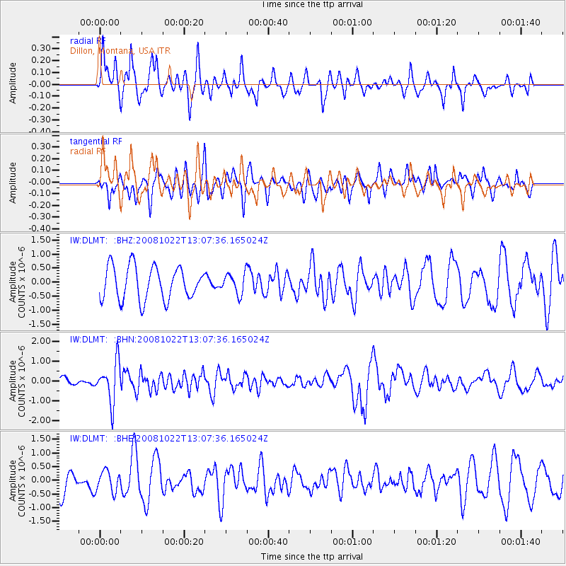
Signal To Noise
| Channel | StoN | STA | LTA |
| IW:DLMT: :BHN:20081022T13:07:36.165024Z | 3.4753137 | 1.0327187E-6 | 2.9715844E-7 |
| IW:DLMT: :BHE:20081022T13:07:36.165024Z | 0.83056194 | 3.776875E-7 | 4.5473732E-7 |
| IW:DLMT: :BHZ:20081022T13:07:36.165024Z | 0.6327754 | 3.7587256E-7 | 5.940062E-7 |
| Arrivals |
| Ps | |
| PpPs | |
| PsPs/PpSs | |


