You are here: Home > Network List > CI - Caltech Regional Seismic Network Stations List
> Station SMM Simmler, CA, USA > Earthquake Result Viewer
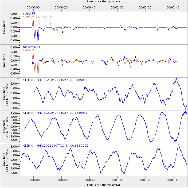
SMM Simmler, CA, USA - Earthquake Result Viewer
*The percent match for this event was below the threshold and hence no stack was calculated.
| Earthquake location: |
Kermadec Islands Region |
| Earthquake latitude/longitude: |
-28.8/-176.8 |
| Earthquake time(UTC): |
2021/04/07 (097) 10:42:05 GMT |
| Earthquake Depth: |
10 km |
| Earthquake Magnitude: |
5.4 Mww |
| Earthquake Catalog/Contributor: |
NEIC PDE/us |
|
| Network: |
CI Caltech Regional Seismic Network |
| Station: |
SMM Simmler, CA, USA |
| Lat/Lon: |
35.31 N/120.00 W |
| Elevation: |
599 m |
|
| Distance: |
83.2 deg |
| Az: |
43.541 deg |
| Baz: |
227.678 deg |
| Ray Param: |
$rayparam |
*The percent match for this event was below the threshold and hence was not used in the summary stack. |
|
| Radial Match: |
94.49367 % |
| Radial Bump: |
400 |
| Transverse Match: |
56.7116 % |
| Transverse Bump: |
400 |
| SOD ConfigId: |
24334971 |
| Insert Time: |
2021-04-21 10:48:37.742 +0000 |
| GWidth: |
2.5 |
| Max Bumps: |
400 |
| Tol: |
0.001 |
|
Signal To Noise
| Channel | StoN | STA | LTA |
| CI:SMM: :HHZ:20210407T10:54:00.838003Z | 1.9613799 | 1.4456979E-6 | 7.370821E-7 |
| CI:SMM: :HHN:20210407T10:54:00.838003Z | 1.8344289 | 1.3786581E-6 | 7.515463E-7 |
| CI:SMM: :HHE:20210407T10:54:00.838003Z | 1.0317507 | 8.3966484E-7 | 8.138253E-7 |
| Arrivals |
| Ps | |
| PpPs | |
| PsPs/PpSs | |


