You are here: Home > Network List > US - United States National Seismic Network Stations List
> Station AMTX Amarillo, Texas, USA > Earthquake Result Viewer
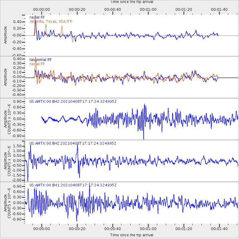
AMTX Amarillo, Texas, USA - Earthquake Result Viewer
*The percent match for this event was below the threshold and hence no stack was calculated.
| Earthquake location: |
Central Alaska |
| Earthquake latitude/longitude: |
63.2/-148.7 |
| Earthquake time(UTC): |
2021/04/08 (098) 17:10:15 GMT |
| Earthquake Depth: |
0.7 km |
| Earthquake Magnitude: |
5.9 ml |
| Earthquake Catalog/Contributor: |
NEIC PDE/ak |
|
| Network: |
US United States National Seismic Network |
| Station: |
AMTX Amarillo, Texas, USA |
| Lat/Lon: |
34.53 N/101.41 W |
| Elevation: |
1010 m |
|
| Distance: |
40.8 deg |
| Az: |
111.865 deg |
| Baz: |
329.349 deg |
| Ray Param: |
$rayparam |
*The percent match for this event was below the threshold and hence was not used in the summary stack. |
|
| Radial Match: |
68.7707 % |
| Radial Bump: |
400 |
| Transverse Match: |
63.519806 % |
| Transverse Bump: |
400 |
| SOD ConfigId: |
24334971 |
| Insert Time: |
2021-04-22 17:29:55.968 +0000 |
| GWidth: |
2.5 |
| Max Bumps: |
400 |
| Tol: |
0.001 |
|
Signal To Noise
| Channel | StoN | STA | LTA |
| US:AMTX:00:BHZ:20210408T17:17:24.324995Z | 0.71291614 | 2.500931E-7 | 3.50803E-7 |
| US:AMTX:00:BH1:20210408T17:17:24.324995Z | 2.2348123 | 3.5903233E-7 | 1.6065437E-7 |
| US:AMTX:00:BH2:20210408T17:17:24.324995Z | 1.4311136 | 1.4357136E-7 | 1.0032143E-7 |
| Arrivals |
| Ps | |
| PpPs | |
| PsPs/PpSs | |


