You are here: Home > Network List > GS - US Geological Survey Networks Stations List
> Station KAN08 Anthony NE Station > Earthquake Result Viewer
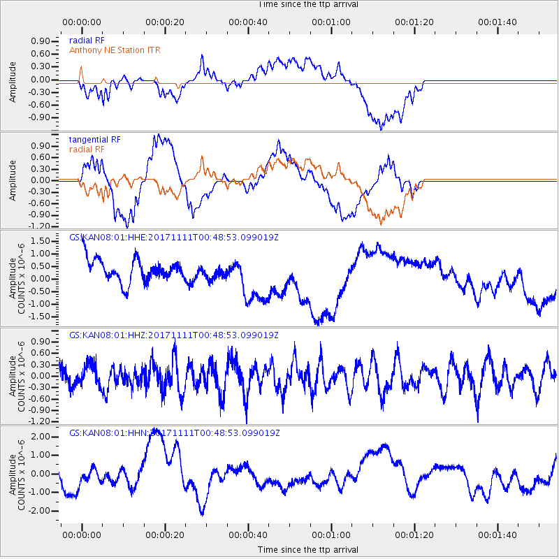
KAN08 Anthony NE Station - Earthquake Result Viewer
*The percent match for this event was below the threshold and hence no stack was calculated.
| Earthquake location: |
Ascension Island Region |
| Earthquake latitude/longitude: |
-11.7/-14.1 |
| Earthquake time(UTC): |
2017/11/11 (315) 00:36:14 GMT |
| Earthquake Depth: |
10 km |
| Earthquake Magnitude: |
6.1 Mww |
| Earthquake Catalog/Contributor: |
NEIC PDE/us |
|
| Network: |
GS US Geological Survey Networks |
| Station: |
KAN08 Anthony NE Station |
| Lat/Lon: |
37.23 N/97.97 W |
| Elevation: |
375 m |
|
| Distance: |
92.2 deg |
| Az: |
307.421 deg |
| Baz: |
102.985 deg |
| Ray Param: |
$rayparam |
*The percent match for this event was below the threshold and hence was not used in the summary stack. |
|
| Radial Match: |
30.954802 % |
| Radial Bump: |
400 |
| Transverse Match: |
70.52622 % |
| Transverse Bump: |
400 |
| SOD ConfigId: |
2429771 |
| Insert Time: |
2017-11-25 00:37:45.947 +0000 |
| GWidth: |
2.5 |
| Max Bumps: |
400 |
| Tol: |
0.001 |
|
Signal To Noise
| Channel | StoN | STA | LTA |
| GS:KAN08:01:HHZ:20171111T00:48:53.099019Z | 0.9631217 | 2.8081135E-7 | 2.9156374E-7 |
| GS:KAN08:01:HHN:20171111T00:48:53.099019Z | 0.9861251 | 3.946261E-7 | 4.0017855E-7 |
| GS:KAN08:01:HHE:20171111T00:48:53.099019Z | 0.61044514 | 2.7820968E-7 | 4.5574888E-7 |
| Arrivals |
| Ps | |
| PpPs | |
| PsPs/PpSs | |


