You are here: Home > Network List > US - United States National Seismic Network Stations List
> Station WMOK Wichita Mountains, Oklahoma, USA > Earthquake Result Viewer
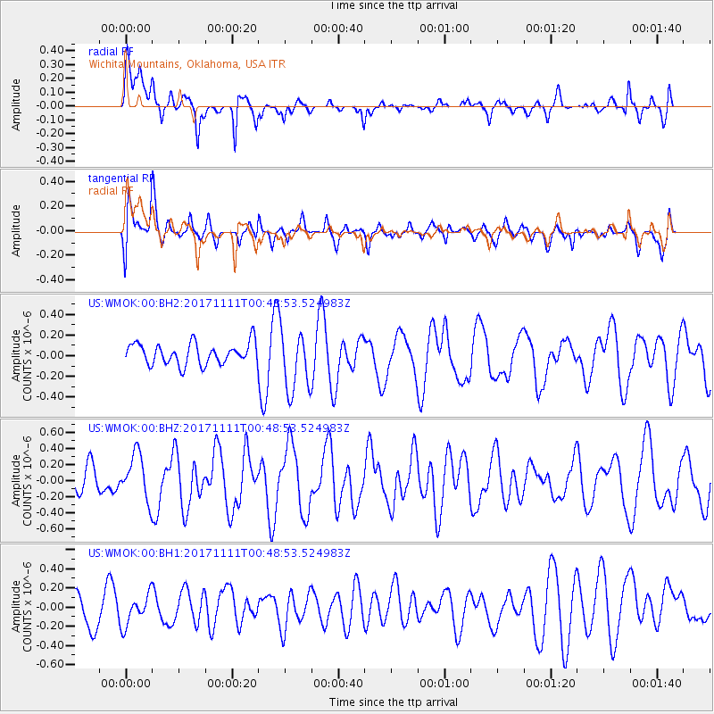
WMOK Wichita Mountains, Oklahoma, USA - Earthquake Result Viewer
*The percent match for this event was below the threshold and hence no stack was calculated.
| Earthquake location: |
Ascension Island Region |
| Earthquake latitude/longitude: |
-11.7/-14.1 |
| Earthquake time(UTC): |
2017/11/11 (315) 00:36:14 GMT |
| Earthquake Depth: |
10 km |
| Earthquake Magnitude: |
6.1 Mww |
| Earthquake Catalog/Contributor: |
NEIC PDE/us |
|
| Network: |
US United States National Seismic Network |
| Station: |
WMOK Wichita Mountains, Oklahoma, USA |
| Lat/Lon: |
34.74 N/98.78 W |
| Elevation: |
486 m |
|
| Distance: |
92.3 deg |
| Az: |
304.851 deg |
| Baz: |
102.611 deg |
| Ray Param: |
$rayparam |
*The percent match for this event was below the threshold and hence was not used in the summary stack. |
|
| Radial Match: |
70.09755 % |
| Radial Bump: |
400 |
| Transverse Match: |
68.67867 % |
| Transverse Bump: |
400 |
| SOD ConfigId: |
2429771 |
| Insert Time: |
2017-11-25 00:40:46.039 +0000 |
| GWidth: |
2.5 |
| Max Bumps: |
400 |
| Tol: |
0.001 |
|
Signal To Noise
| Channel | StoN | STA | LTA |
| US:WMOK:00:BHZ:20171111T00:48:53.524983Z | 1.0112257 | 2.881895E-7 | 2.8499028E-7 |
| US:WMOK:00:BH1:20171111T00:48:53.524983Z | 0.56581795 | 1.5709884E-7 | 2.776491E-7 |
| US:WMOK:00:BH2:20171111T00:48:53.524983Z | 2.8657928 | 2.946106E-7 | 1.0280248E-7 |
| Arrivals |
| Ps | |
| PpPs | |
| PsPs/PpSs | |


