You are here: Home > Network List > IW - Intermountain West Stations List
> Station IMW Indian Meadow, Wyoming, USA > Earthquake Result Viewer
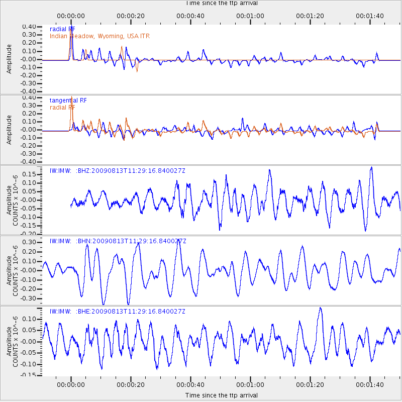
IMW Indian Meadow, Wyoming, USA - Earthquake Result Viewer
*The percent match for this event was below the threshold and hence no stack was calculated.
| Earthquake location: |
Tonga Islands |
| Earthquake latitude/longitude: |
-21.7/-174.6 |
| Earthquake time(UTC): |
2009/08/13 (225) 11:17:01 GMT |
| Earthquake Depth: |
10 km |
| Earthquake Magnitude: |
5.6 MW, 5.3 MB |
| Earthquake Catalog/Contributor: |
WHDF/NEIC |
|
| Network: |
IW Intermountain West |
| Station: |
IMW Indian Meadow, Wyoming, USA |
| Lat/Lon: |
43.90 N/110.94 W |
| Elevation: |
2646 m |
|
| Distance: |
87.4 deg |
| Az: |
40.415 deg |
| Baz: |
236.538 deg |
| Ray Param: |
$rayparam |
*The percent match for this event was below the threshold and hence was not used in the summary stack. |
|
| Radial Match: |
77.12104 % |
| Radial Bump: |
306 |
| Transverse Match: |
67.96963 % |
| Transverse Bump: |
400 |
| SOD ConfigId: |
2622 |
| Insert Time: |
2010-03-09 07:18:26.126 +0000 |
| GWidth: |
2.5 |
| Max Bumps: |
400 |
| Tol: |
0.001 |
|
Signal To Noise
| Channel | StoN | STA | LTA |
| IW:IMW: :BHN:20090813T11:29:16.840027Z | 2.3874376 | 1.2456931E-7 | 5.217699E-8 |
| IW:IMW: :BHE:20090813T11:29:16.840027Z | 1.0743597 | 4.06136E-8 | 3.780261E-8 |
| IW:IMW: :BHZ:20090813T11:29:16.840027Z | 0.93936414 | 2.7884338E-8 | 2.968427E-8 |
| Arrivals |
| Ps | |
| PpPs | |
| PsPs/PpSs | |


