You are here: Home > Network List > IW - Intermountain West Stations List
> Station IMW Indian Meadow, Wyoming, USA > Earthquake Result Viewer
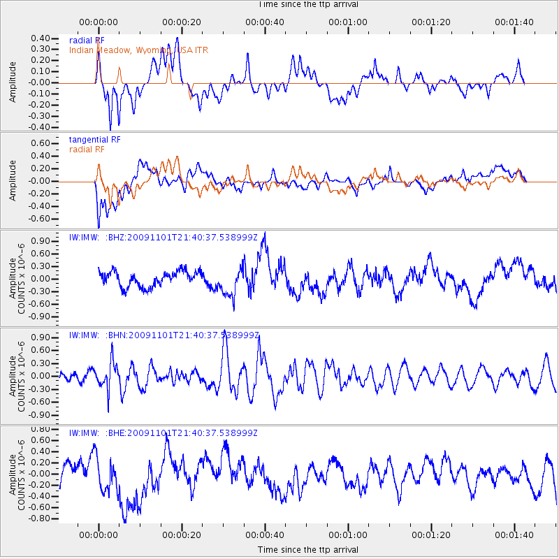
IMW Indian Meadow, Wyoming, USA - Earthquake Result Viewer
*The percent match for this event was below the threshold and hence no stack was calculated.
| Earthquake location: |
Tonga Islands |
| Earthquake latitude/longitude: |
-15.5/-173.8 |
| Earthquake time(UTC): |
2009/11/01 (305) 21:28:58 GMT |
| Earthquake Depth: |
105 km |
| Earthquake Magnitude: |
5.8 MW, 5.4 MB, 5.8 MW |
| Earthquake Catalog/Contributor: |
WHDF/NEIC |
|
| Network: |
IW Intermountain West |
| Station: |
IMW Indian Meadow, Wyoming, USA |
| Lat/Lon: |
43.90 N/110.94 W |
| Elevation: |
2646 m |
|
| Distance: |
82.2 deg |
| Az: |
40.464 deg |
| Baz: |
239.936 deg |
| Ray Param: |
$rayparam |
*The percent match for this event was below the threshold and hence was not used in the summary stack. |
|
| Radial Match: |
62.020035 % |
| Radial Bump: |
400 |
| Transverse Match: |
47.24714 % |
| Transverse Bump: |
400 |
| SOD ConfigId: |
2622 |
| Insert Time: |
2010-03-09 07:18:41.727 +0000 |
| GWidth: |
2.5 |
| Max Bumps: |
400 |
| Tol: |
0.001 |
|
Signal To Noise
| Channel | StoN | STA | LTA |
| IW:IMW: :BHN:20091101T21:40:37.538999Z | 3.0811977 | 3.070579E-7 | 9.965536E-8 |
| IW:IMW: :BHE:20091101T21:40:37.538999Z | 1.1681278 | 2.9687632E-7 | 2.5414712E-7 |
| IW:IMW: :BHZ:20091101T21:40:37.538999Z | 1.8888779 | 3.3965787E-7 | 1.7981992E-7 |
| Arrivals |
| Ps | |
| PpPs | |
| PsPs/PpSs | |


