You are here: Home > Network List > IW - Intermountain West Stations List
> Station IMW Indian Meadow, Wyoming, USA > Earthquake Result Viewer
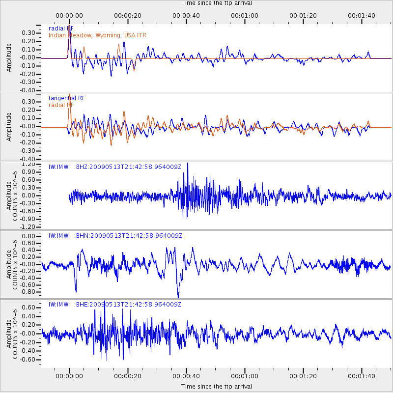
IMW Indian Meadow, Wyoming, USA - Earthquake Result Viewer
*The percent match for this event was below the threshold and hence no stack was calculated.
| Earthquake location: |
Tonga Islands |
| Earthquake latitude/longitude: |
-15.8/-173.5 |
| Earthquake time(UTC): |
2009/05/13 (133) 21:31:17 GMT |
| Earthquake Depth: |
85 km |
| Earthquake Magnitude: |
5.8 MW, 5.3 MB, 5.8 MW |
| Earthquake Catalog/Contributor: |
WHDF/NEIC |
|
| Network: |
IW Intermountain West |
| Station: |
IMW Indian Meadow, Wyoming, USA |
| Lat/Lon: |
43.90 N/110.94 W |
| Elevation: |
2646 m |
|
| Distance: |
82.3 deg |
| Az: |
40.346 deg |
| Baz: |
239.582 deg |
| Ray Param: |
$rayparam |
*The percent match for this event was below the threshold and hence was not used in the summary stack. |
|
| Radial Match: |
77.58548 % |
| Radial Bump: |
400 |
| Transverse Match: |
51.515694 % |
| Transverse Bump: |
400 |
| SOD ConfigId: |
2760 |
| Insert Time: |
2010-03-09 07:19:18.581 +0000 |
| GWidth: |
2.5 |
| Max Bumps: |
400 |
| Tol: |
0.001 |
|
Signal To Noise
| Channel | StoN | STA | LTA |
| IW:IMW: :BHN:20090513T21:42:58.964009Z | 3.94006 | 2.893627E-7 | 7.344119E-8 |
| IW:IMW: :BHE:20090513T21:42:58.964009Z | 1.0722141 | 8.84903E-8 | 8.2530434E-8 |
| IW:IMW: :BHZ:20090513T21:42:58.964009Z | 1.0963061 | 1.2465077E-7 | 1.1370069E-7 |
| Arrivals |
| Ps | |
| PpPs | |
| PsPs/PpSs | |


