You are here: Home > Network List > IW - Intermountain West Stations List
> Station IMW Indian Meadow, Wyoming, USA > Earthquake Result Viewer
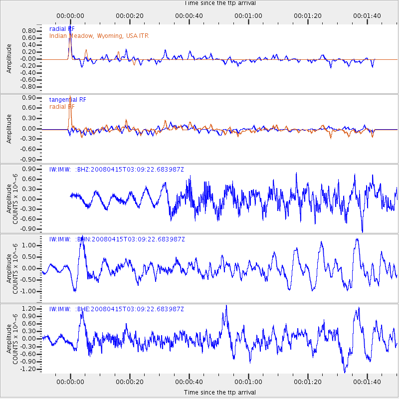
IMW Indian Meadow, Wyoming, USA - Earthquake Result Viewer
*The percent match for this event was below the threshold and hence no stack was calculated.
| Earthquake location: |
Near Coast Of Guatemala |
| Earthquake latitude/longitude: |
13.6/-90.6 |
| Earthquake time(UTC): |
2008/04/15 (106) 03:03:04 GMT |
| Earthquake Depth: |
33 km |
| Earthquake Magnitude: |
5.6 MB, 5.8 MS, 6.1 MW, 6.1 MW |
| Earthquake Catalog/Contributor: |
WHDF/NEIC |
|
| Network: |
IW Intermountain West |
| Station: |
IMW Indian Meadow, Wyoming, USA |
| Lat/Lon: |
43.90 N/110.94 W |
| Elevation: |
2646 m |
|
| Distance: |
34.9 deg |
| Az: |
333.945 deg |
| Baz: |
143.782 deg |
| Ray Param: |
$rayparam |
*The percent match for this event was below the threshold and hence was not used in the summary stack. |
|
| Radial Match: |
75.76989 % |
| Radial Bump: |
400 |
| Transverse Match: |
51.82246 % |
| Transverse Bump: |
400 |
| SOD ConfigId: |
2504 |
| Insert Time: |
2010-03-09 07:19:26.385 +0000 |
| GWidth: |
2.5 |
| Max Bumps: |
400 |
| Tol: |
0.001 |
|
Signal To Noise
| Channel | StoN | STA | LTA |
| IW:IMW: :BHN:20080415T03:09:22.683987Z | 4.7553616 | 7.843094E-7 | 1.649316E-7 |
| IW:IMW: :BHE:20080415T03:09:22.683987Z | 5.55163 | 5.1854704E-7 | 9.3404466E-8 |
| IW:IMW: :BHZ:20080415T03:09:22.683987Z | 2.3681958 | 3.2804772E-7 | 1.3852221E-7 |
| Arrivals |
| Ps | |
| PpPs | |
| PsPs/PpSs | |


