You are here: Home > Network List > AV - Alaska Volcano Observatory Stations List
> Station SPCR Ckakachatna River, Mount Spurr, Alaska > Earthquake Result Viewer
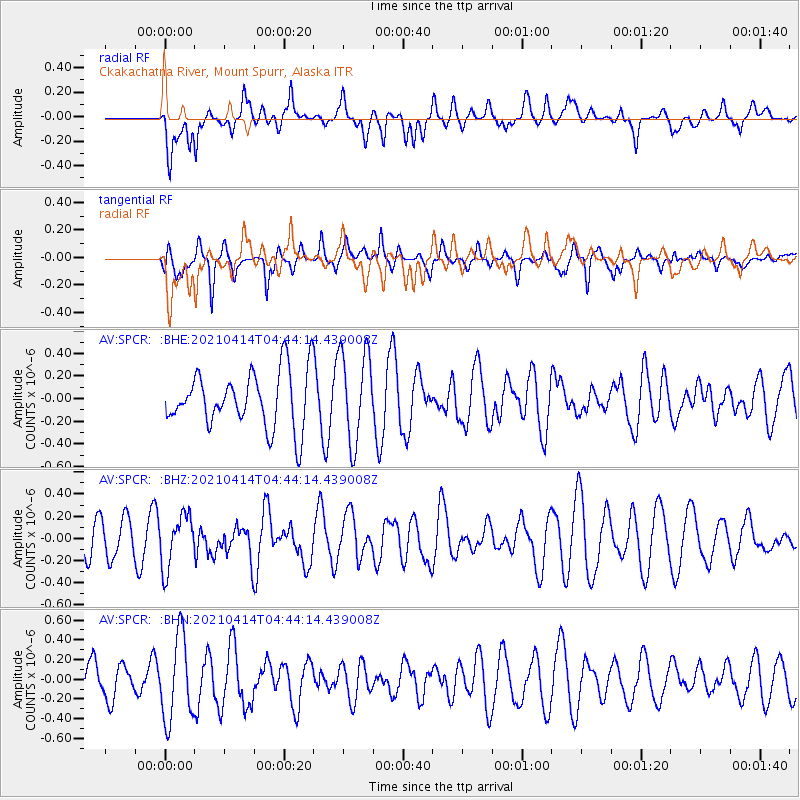
SPCR Ckakachatna River, Mount Spurr, Alaska - Earthquake Result Viewer
*The percent match for this event was below the threshold and hence no stack was calculated.
| Earthquake location: |
Galapagos Triple Junction Region |
| Earthquake latitude/longitude: |
1.8/-101.0 |
| Earthquake time(UTC): |
2021/04/14 (104) 04:33:29 GMT |
| Earthquake Depth: |
10 km |
| Earthquake Magnitude: |
5.7 Mww |
| Earthquake Catalog/Contributor: |
NEIC PDE/us |
|
| Network: |
AV Alaska Volcano Observatory |
| Station: |
SPCR Ckakachatna River, Mount Spurr, Alaska |
| Lat/Lon: |
61.20 N/152.21 W |
| Elevation: |
984 m |
|
| Distance: |
70.7 deg |
| Az: |
336.423 deg |
| Baz: |
124.353 deg |
| Ray Param: |
$rayparam |
*The percent match for this event was below the threshold and hence was not used in the summary stack. |
|
| Radial Match: |
47.40263 % |
| Radial Bump: |
400 |
| Transverse Match: |
69.614876 % |
| Transverse Bump: |
356 |
| SOD ConfigId: |
24334971 |
| Insert Time: |
2021-04-28 04:38:08.079 +0000 |
| GWidth: |
2.5 |
| Max Bumps: |
400 |
| Tol: |
0.001 |
|
Signal To Noise
| Channel | StoN | STA | LTA |
| AV:SPCR: :BHZ:20210414T04:44:14.439008Z | 1.3841617 | 2.3606886E-7 | 1.7055005E-7 |
| AV:SPCR: :BHN:20210414T04:44:14.439008Z | 1.9320612 | 4.2579742E-7 | 2.2038506E-7 |
| AV:SPCR: :BHE:20210414T04:44:14.439008Z | 1.5996486 | 3.9895534E-7 | 2.4940186E-7 |
| Arrivals |
| Ps | |
| PpPs | |
| PsPs/PpSs | |


