You are here: Home > Network List > GS - US Geological Survey Networks Stations List
> Station DEC06 Boomer > Earthquake Result Viewer
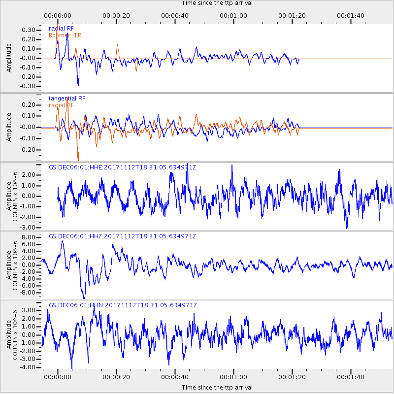
DEC06 Boomer - Earthquake Result Viewer
*The percent match for this event was below the threshold and hence no stack was calculated.
| Earthquake location: |
Iran-Iraq Border Region |
| Earthquake latitude/longitude: |
34.9/46.0 |
| Earthquake time(UTC): |
2017/11/12 (316) 18:18:17 GMT |
| Earthquake Depth: |
19 km |
| Earthquake Magnitude: |
7.3 Mww |
| Earthquake Catalog/Contributor: |
NEIC PDE/us |
|
| Network: |
GS US Geological Survey Networks |
| Station: |
DEC06 Boomer |
| Lat/Lon: |
39.90 N/88.95 W |
| Elevation: |
215 m |
|
| Distance: |
94.7 deg |
| Az: |
326.854 deg |
| Baz: |
35.742 deg |
| Ray Param: |
$rayparam |
*The percent match for this event was below the threshold and hence was not used in the summary stack. |
|
| Radial Match: |
73.280014 % |
| Radial Bump: |
400 |
| Transverse Match: |
63.941914 % |
| Transverse Bump: |
400 |
| SOD ConfigId: |
2429771 |
| Insert Time: |
2017-11-26 18:19:41.634 +0000 |
| GWidth: |
2.5 |
| Max Bumps: |
400 |
| Tol: |
0.001 |
|
Signal To Noise
| Channel | StoN | STA | LTA |
| GS:DEC06:01:HHZ:20171112T18:31:05.634971Z | 2.933038 | 3.366089E-6 | 1.1476459E-6 |
| GS:DEC06:01:HHN:20171112T18:31:05.634971Z | 1.1315174 | 1.1332276E-6 | 1.0015114E-6 |
| GS:DEC06:01:HHE:20171112T18:31:05.634971Z | 1.2537675 | 9.553689E-7 | 7.619984E-7 |
| Arrivals |
| Ps | |
| PpPs | |
| PsPs/PpSs | |


