You are here: Home > Network List > TA - USArray Transportable Network (new EarthScope stations) Stations List
> Station A36M Sachs Harbour, NT, CAN > Earthquake Result Viewer
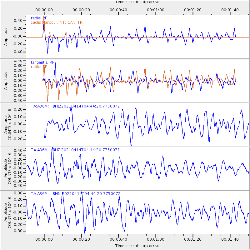
A36M Sachs Harbour, NT, CAN - Earthquake Result Viewer
*The percent match for this event was below the threshold and hence no stack was calculated.
| Earthquake location: |
Galapagos Triple Junction Region |
| Earthquake latitude/longitude: |
1.8/-101.0 |
| Earthquake time(UTC): |
2021/04/14 (104) 04:33:29 GMT |
| Earthquake Depth: |
10 km |
| Earthquake Magnitude: |
5.7 Mww |
| Earthquake Catalog/Contributor: |
NEIC PDE/us |
|
| Network: |
TA USArray Transportable Network (new EarthScope stations) |
| Station: |
A36M Sachs Harbour, NT, CAN |
| Lat/Lon: |
71.99 N/125.25 W |
| Elevation: |
32 m |
|
| Distance: |
71.7 deg |
| Az: |
352.268 deg |
| Baz: |
154.39 deg |
| Ray Param: |
$rayparam |
*The percent match for this event was below the threshold and hence was not used in the summary stack. |
|
| Radial Match: |
62.91513 % |
| Radial Bump: |
400 |
| Transverse Match: |
58.36778 % |
| Transverse Bump: |
400 |
| SOD ConfigId: |
24334971 |
| Insert Time: |
2021-04-28 04:51:28.929 +0000 |
| GWidth: |
2.5 |
| Max Bumps: |
400 |
| Tol: |
0.001 |
|
Signal To Noise
| Channel | StoN | STA | LTA |
| TA:A36M: :BHZ:20210414T04:44:20.775007Z | 2.8130567 | 2.165713E-7 | 7.698789E-8 |
| TA:A36M: :BHN:20210414T04:44:20.775007Z | 0.98395747 | 1.1611232E-7 | 1.18005424E-7 |
| TA:A36M: :BHE:20210414T04:44:20.775007Z | 1.1054127 | 8.0527606E-8 | 7.284845E-8 |
| Arrivals |
| Ps | |
| PpPs | |
| PsPs/PpSs | |


