You are here: Home > Network List > IU - Global Seismograph Network (GSN - IRIS/USGS) Stations List
> Station RSSD Black Hills, South Dakota, USA > Earthquake Result Viewer
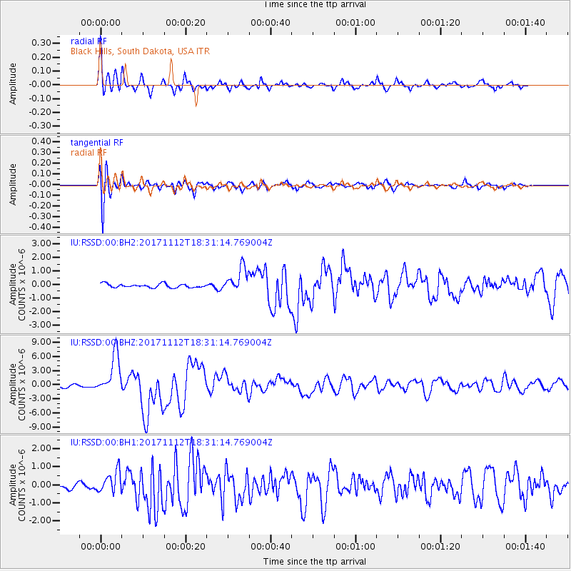
RSSD Black Hills, South Dakota, USA - Earthquake Result Viewer
*The percent match for this event was below the threshold and hence no stack was calculated.
| Earthquake location: |
Iran-Iraq Border Region |
| Earthquake latitude/longitude: |
34.9/46.0 |
| Earthquake time(UTC): |
2017/11/12 (316) 18:18:17 GMT |
| Earthquake Depth: |
19 km |
| Earthquake Magnitude: |
7.3 Mww |
| Earthquake Catalog/Contributor: |
NEIC PDE/us |
|
| Network: |
IU Global Seismograph Network (GSN - IRIS/USGS) |
| Station: |
RSSD Black Hills, South Dakota, USA |
| Lat/Lon: |
44.12 N/104.04 W |
| Elevation: |
2090 m |
|
| Distance: |
96.7 deg |
| Az: |
338.734 deg |
| Baz: |
24.451 deg |
| Ray Param: |
$rayparam |
*The percent match for this event was below the threshold and hence was not used in the summary stack. |
|
| Radial Match: |
90.71915 % |
| Radial Bump: |
322 |
| Transverse Match: |
79.36486 % |
| Transverse Bump: |
400 |
| SOD ConfigId: |
2429771 |
| Insert Time: |
2017-11-26 18:20:35.881 +0000 |
| GWidth: |
2.5 |
| Max Bumps: |
400 |
| Tol: |
0.001 |
|
Signal To Noise
| Channel | StoN | STA | LTA |
| IU:RSSD:00:BHZ:20171112T18:31:14.769004Z | 13.1195345 | 4.3144228E-6 | 3.2885487E-7 |
| IU:RSSD:00:BH1:20171112T18:31:14.769004Z | 1.8378133 | 6.110768E-7 | 3.3250214E-7 |
| IU:RSSD:00:BH2:20171112T18:31:14.769004Z | 6.8086715 | 9.395629E-7 | 1.3799503E-7 |
| Arrivals |
| Ps | |
| PpPs | |
| PsPs/PpSs | |


