You are here: Home > Network List > CI - Caltech Regional Seismic Network Stations List
> Station TIN Tinemaha, Big Pine, CA, USA > Earthquake Result Viewer
TIN Tinemaha, Big Pine, CA, USA - Earthquake Result Viewer
*The percent match for this event was below the threshold and hence no stack was calculated.
| Earthquake location: |
Near East Coast Of Honshu, Japan |
| Earthquake latitude/longitude: |
38.4/141.9 |
| Earthquake time(UTC): |
2021/04/18 (108) 00:29:12 GMT |
| Earthquake Depth: |
52 km |
| Earthquake Magnitude: |
5.6 mww |
| Earthquake Catalog/Contributor: |
NEIC PDE/us |
|
| Network: |
CI Caltech Regional Seismic Network |
| Station: |
TIN Tinemaha, Big Pine, CA, USA |
| Lat/Lon: |
37.05 N/118.23 W |
| Elevation: |
1197 m |
|
| Distance: |
74.7 deg |
| Az: |
54.782 deg |
| Baz: |
306.599 deg |
| Ray Param: |
$rayparam |
*The percent match for this event was below the threshold and hence was not used in the summary stack. |
|
| Radial Match: |
48.979435 % |
| Radial Bump: |
400 |
| Transverse Match: |
56.060505 % |
| Transverse Bump: |
400 |
| SOD ConfigId: |
24334971 |
| Insert Time: |
2021-05-02 00:39:55.895 +0000 |
| GWidth: |
2.5 |
| Max Bumps: |
400 |
| Tol: |
0.001 |
|
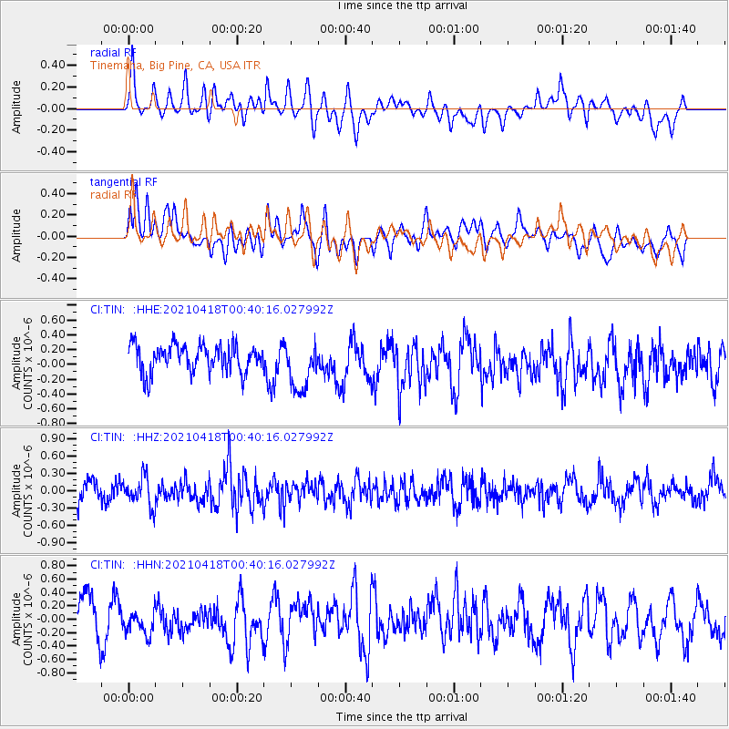
Signal To Noise
| Channel | StoN | STA | LTA |
| CI:TIN: :HHZ:20210418T00:40:16.027992Z | 1.5076182 | 2.5077756E-7 | 1.6634023E-7 |
| CI:TIN: :HHN:20210418T00:40:16.027992Z | 0.7878841 | 1.8931692E-7 | 2.4028523E-7 |
| CI:TIN: :HHE:20210418T00:40:16.027992Z | 1.8273821 | 3.3623343E-7 | 1.8399733E-7 |
| Arrivals |
| Ps | |
| PpPs | |
| PsPs/PpSs | |


