You are here: Home > Network List > TA - USArray Transportable Network (new EarthScope stations) Stations List
> Station E20K Nigu River, AK, USA > Earthquake Result Viewer
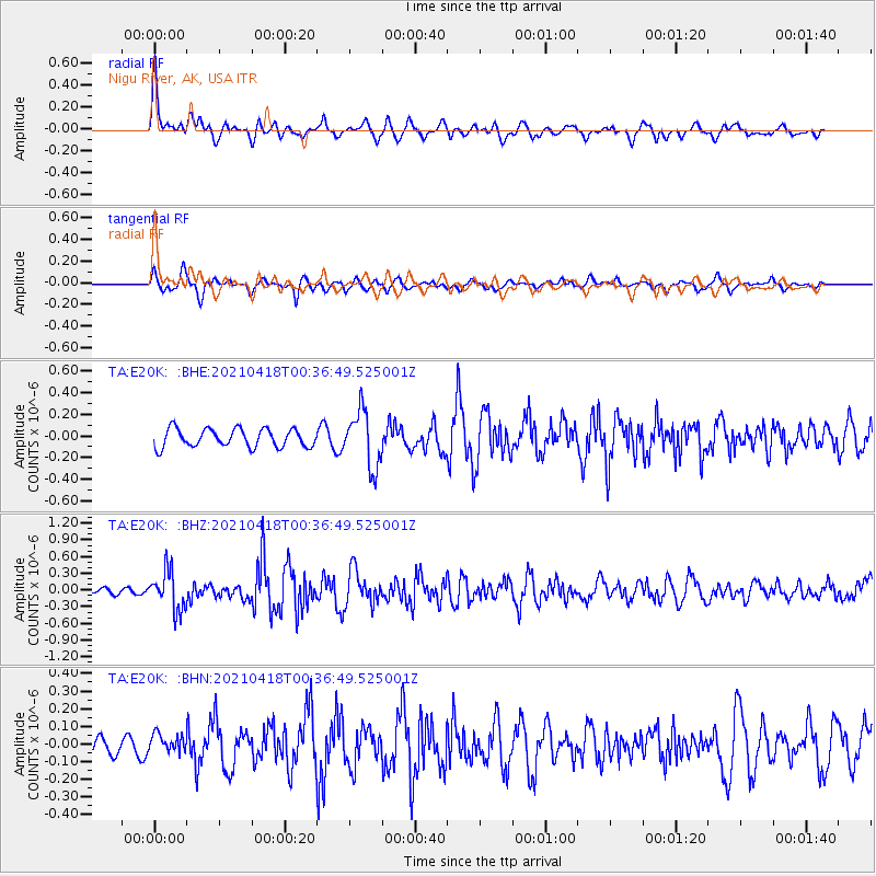
E20K Nigu River, AK, USA - Earthquake Result Viewer
*The percent match for this event was below the threshold and hence no stack was calculated.
| Earthquake location: |
Near East Coast Of Honshu, Japan |
| Earthquake latitude/longitude: |
38.4/141.9 |
| Earthquake time(UTC): |
2021/04/18 (108) 00:29:12 GMT |
| Earthquake Depth: |
52 km |
| Earthquake Magnitude: |
5.6 mww |
| Earthquake Catalog/Contributor: |
NEIC PDE/us |
|
| Network: |
TA USArray Transportable Network (new EarthScope stations) |
| Station: |
E20K Nigu River, AK, USA |
| Lat/Lon: |
68.26 N/156.19 W |
| Elevation: |
866 m |
|
| Distance: |
44.6 deg |
| Az: |
27.887 deg |
| Baz: |
260.72 deg |
| Ray Param: |
$rayparam |
*The percent match for this event was below the threshold and hence was not used in the summary stack. |
|
| Radial Match: |
70.11328 % |
| Radial Bump: |
400 |
| Transverse Match: |
81.67388 % |
| Transverse Bump: |
400 |
| SOD ConfigId: |
24334971 |
| Insert Time: |
2021-05-02 00:51:30.287 +0000 |
| GWidth: |
2.5 |
| Max Bumps: |
400 |
| Tol: |
0.001 |
|
Signal To Noise
| Channel | StoN | STA | LTA |
| TA:E20K: :BHZ:20210418T00:36:49.525001Z | 5.624118 | 3.468283E-7 | 6.166804E-8 |
| TA:E20K: :BHN:20210418T00:36:49.525001Z | 0.9642608 | 5.3238125E-8 | 5.521133E-8 |
| TA:E20K: :BHE:20210418T00:36:49.525001Z | 3.0974512 | 2.5967634E-7 | 8.383549E-8 |
| Arrivals |
| Ps | |
| PpPs | |
| PsPs/PpSs | |


