You are here: Home > Network List > US - United States National Seismic Network Stations List
> Station MSO Missoula, Montana, USA > Earthquake Result Viewer
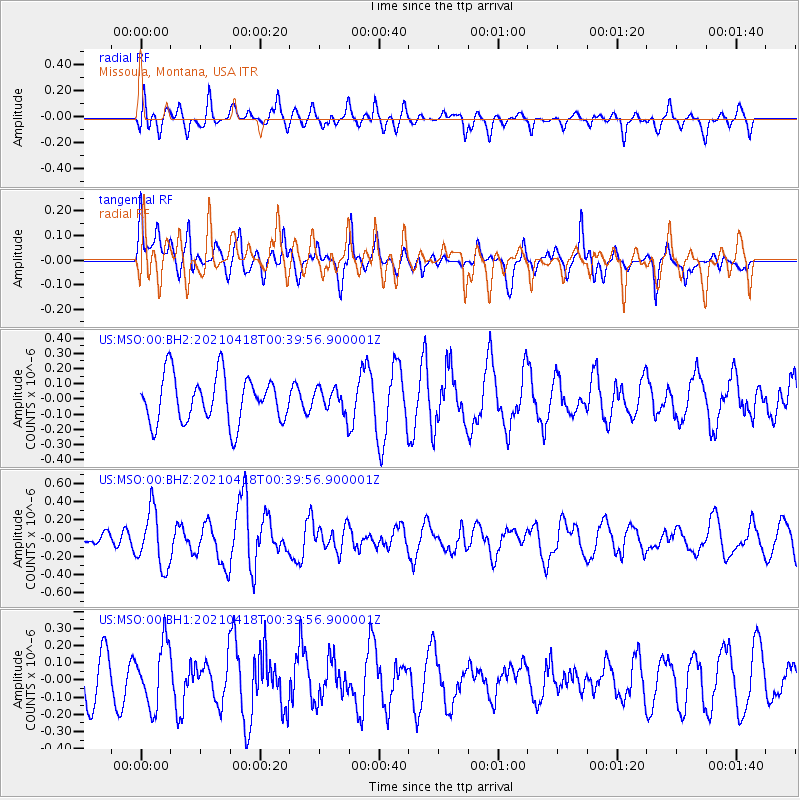
MSO Missoula, Montana, USA - Earthquake Result Viewer
*The percent match for this event was below the threshold and hence no stack was calculated.
| Earthquake location: |
Near East Coast Of Honshu, Japan |
| Earthquake latitude/longitude: |
38.4/141.9 |
| Earthquake time(UTC): |
2021/04/18 (108) 00:29:12 GMT |
| Earthquake Depth: |
52 km |
| Earthquake Magnitude: |
5.6 mww |
| Earthquake Catalog/Contributor: |
NEIC PDE/us |
|
| Network: |
US United States National Seismic Network |
| Station: |
MSO Missoula, Montana, USA |
| Lat/Lon: |
46.83 N/113.94 W |
| Elevation: |
1264 m |
|
| Distance: |
71.5 deg |
| Az: |
44.593 deg |
| Baz: |
306.5 deg |
| Ray Param: |
$rayparam |
*The percent match for this event was below the threshold and hence was not used in the summary stack. |
|
| Radial Match: |
47.819714 % |
| Radial Bump: |
400 |
| Transverse Match: |
54.699825 % |
| Transverse Bump: |
355 |
| SOD ConfigId: |
24334971 |
| Insert Time: |
2021-05-02 00:54:26.975 +0000 |
| GWidth: |
2.5 |
| Max Bumps: |
400 |
| Tol: |
0.001 |
|
Signal To Noise
| Channel | StoN | STA | LTA |
| US:MSO:00:BHZ:20210418T00:39:56.900001Z | 3.3305283 | 3.0914086E-7 | 9.2820365E-8 |
| US:MSO:00:BH1:20210418T00:39:56.900001Z | 1.231691 | 1.806209E-7 | 1.4664465E-7 |
| US:MSO:00:BH2:20210418T00:39:56.900001Z | 0.5241394 | 8.0731105E-8 | 1.5402601E-7 |
| Arrivals |
| Ps | |
| PpPs | |
| PsPs/PpSs | |


